DESCRIPTION
  • TRY BEFORE YOU BUY
    • Experience the quality and detail before making a purchase
    • Get a FREE sample scene! — www.anyscape.io/tunis-tun
  • WHAT IS INCLUDED
    • DETAILS
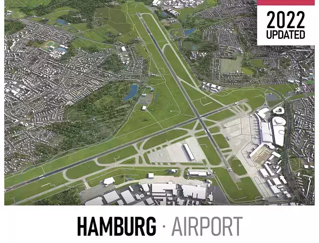
      • Scene Size: Entire airport — extents shown in promo images
      • Units: Meters — real-world scale
    • KEY BENEFITS
      • Wide Format Support — 3ds Max (native), fbx, obj, dae, c4d, skp, 3dm, rvt, blend and more
      • Georeferenced — standard CRS, any other as a custom build
      • Crop to Your Area — for a lighter scene, as a custom build
      • Organized in Layers — buildings, land use, roads and railways split by type
      • Detailed Landmarks — more in LOD2 and LOD3 as a custom build
      • Satellite Surface Texture — realistic, 1-meter resolution
      • Easy to Edit — flat surface, topography terrain as a custom build
      • Realistic Low-Poly Trees — individual trees in MAX and FBX
      • Ready to Render — set up for 3ds Max + Corona
    • PRESENTATION IMAGES
      • 4K Renders — show the real level of detail and scene size
      • Made in 3ds Max — results may vary in other software
    • MATERIALS
      • Textures Assigned — trees, vegetation, land use and airport surfaces
      • Buildings Ready for Texturing — UV mapped, split by material IDs, no textures assigned
  • CUSTOM BUILDS — www.anyscape.io/tunis-tun
    • Made to order, not part of this listing
      • Latest Data — rebuilt from the newest data when you order
      • Scheduled Updates — new versions as the data changes
      • Preview First — screenshots of your exact area before you commit
      • Fast Turnaround — timed to your project
    • SCENE SIZE
      • Your Area — from a small section to 1000 x 1000 km
      • Several Cities in One Scene — metro areas and whole regions too
      • Better Performance — cropped or split into tiles
    • DATA AUTHENTICITY
      • 100% Real Buildings — real footprints, no AI-generated data
      • Your Own Data — merged into the model
    • GEOREFERENCING
      • Any CRS — Web Mercator, UTM, national grids or source CRS
      • 3D Tiles for Cesium — valid tilesets, correctly placed on the globe
      • Seamless Tiles — on a CRS grid, no gaps or offsets between tiles
      • Exact Origin — real-world position kept, origin where you set it
    • TOPOGRAPHY TERRAIN
      • Accurate Terrain — digital terrain model up to 1 meter
      • Multiple LODs — meshes balanced for detail and performance
      • Buildings and Roads on Terrain — sit correctly, no floating or sinking
      • Separate Land and Water — modeled apart for more control
      • Contour Lines — 3D splines, up to 1-meter intervals
    • MANUAL MODELING
      • Detailed Buildings — LOD2 and LOD3
      • Road Infrastructure — elevated highways, interchanges, bridges and flyovers
    • TEXTURING
      • Sharper Imagery — satellite images up to 0.1 meter
      • Road Markings — UV mapped along streets and roads
      • Building Textures — procedural or realistic
    • VEGETATION OPTIONS
      • Individual Trees — placed from real-world data
      • Procedural Forests — forest areas converted to individual trees
    • ADDITIONAL FEATURES
      • Named Objects — buildings and streets with names or addresses
      • Administrative Boundaries — polygons or outlines, all levels
      • Traffic Splines — roads and railways, ready for animation
      • Public Transport Stops — individual named objects
    • FILE FORMATS
      • max — Autodesk 3ds Max
      • fbx, obj, dae, 3ds — Exchange Formats
      • unitypackage — Unity 3D
      • uproject, uasset — Unreal Engine
      • tm — Twinmotion
      • 3dm — Rhino 3D
      • skp — SketchUp
      • rvt — Autodesk Revit
      • pln — Archicad
      • c4d — Cinema4D
      • lsf — Lumion
      • blend — Blender
      • glb, gltf — Games, Web, AR/VR
      • ma, mb — Autodesk Maya
      • dwg, dxf — Autodesk AutoCAD
      • stl — 3D Print

REVIEWS & COMMENTS

See what other buyers think about this model - real feedback on quality,
accuracy, and usability.
BEST PRICE GUARANTEED
Found this model cheaper on another marketplace? Let our support team know - we’ll match it.

Tunis - Carthage Airport Low-poly 3D model

$199.00
Royalty Free License
Like this model to show appreciation to the designer.
See how many times this model was viewed.
Share this model to support the designer and boost their visibility.
Native file format
MAX3 files
Size: 25.1 MB
Exchange formats
OBJ
OBJ<br />File Size: 11.6 MB
FBX
Autodesk FBX | 2 files<br />File Size: 46.5 MB
GLTF
glTF<br />File Size: 8.08 MB
C4D
Cinema 4D<br />File Size: 8.76 MB
FBM
fbm<br />File Size: 8.76 MB
DWG
AutoCAD<br />File Size: 25.2 MB
PDF
PDF<br />File Size: 8.08 MB
3DM
Rhinoceros 3D<br />File Size: 8.08 MB
3DS
3D Studio<br />File Size: 8.08 MB
BLEND
Blender<br />File Size: 8.08 MB
DAE
Collada<br />File Size: 8.08 MB
DXF
DXF<br />File Size: 8.08 MB
LS10
Lumion<br />File Size: 8.08 MB
MA
Autodesk Maya<br />File Size: 8.08 MB
RFA
Autodesk Revit<br />File Size: 8.08 MB
SKP
Sketchup<br />File Size: 8.08 MB
STL
Stereolithography<br />File Size: 8.08 MB
UASSET
UnrealEngine<br />File Size: 8.08 MB
UNITYPACKAGE
Unity 3D<br />File Size: 8.08 MB
Provided by designer
Information and details shared directly by the model's designer.
3D Features
PBR
Uses Physically Based Rendering materials, which give the model realistic lighting and surface properties.
Textures
The model includes image files (textures) that add color, patterns, or detail to its surfaces.
Materials
The model has material settings that define how surfaces look (color, shine, transparency, etc.).
UV Mapping
The model's surfaces are mapped to a 2D image, allowing textures to display correctly.
3D printing
Indicates whether the designer marked this model as suitable for 3D printing.
Model is not 3D printable
The designer indicates this model is intended for digital use only (rendering, animation, or AR/VR) and not for 3D printing.
Geometry
Polygon mesh
A model built from polygons (triangles or quads) connected in a mesh.
1 polygons
The total number of polygons (flat shapes) that make up the 3D model.
/
1 vertices
The number of points (corners) that define the shape of the model's polygons.
Unwrapped UVs
Publish date
Model ID
Chat