1/12
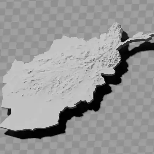
Afghanistan topography relief maps / geography kit
Includes several models:
a cutout with exaggerated terrain / topography [Mercator-projection-distorted version + undistorted version]
simplified version(s) with reduced polygon counts via quadratic decimation
non-cutout versions of the tolopgy [Mercator-projection-distorted version + undistorted version]
a simple 'prism' [flat-surfaced cutout of the country's boundaries with no topology features added]
'expanded' version which is a convex hull of the prism. You can use this as a 'base' to stabilize the model to avoid problems with small details breaking off if you try to 3d print it.
includes STL and OBJ formats. non-textured.
~~~~~~~~~~~~~~~~~~~~~~~~~~~~~~~~~~~~~~~~~~
د افغانستان د توپوګرافۍ نقشې / جغرافیایي کیټ
څو ماډلونه پکې شامل دي:
د مبالغه شوي ځمکني بڼې / توپوګرافۍ سره د پرې شوي برخې ماډل [د مرکاتور پروجیکشن واسطه تحریف شوی نسخه + ناتحریف شوی نسخه]
د څلورضلعي کمولو له لارې د کم شوي پولیګون شمېرې سره ساده شوی نسخه (نسخې)
د توپوګرافۍ ناپرې شوي نسخې [د مرکاتور پروجیکشن واسطه تحریف شوی نسخه + ناتحریف شوی نسخه]
ساده 'منشور' [د هېواد د پولو هواره-سطحه پرې شوې برخه چې هیڅ توپوګرافیک ځانګړتیاوې نلري]
د منشور د محدب پوښ 'پراخه شوی' نسخه. تاسو کولی شئ دا د ماډل د ثبات لپاره د 'بنسټ' په توګه وکاروئ ترڅو د 3D چاپ هڅه کې د وړو جزئیاتو د ماتېدو ستونزو مخه ونیسئ.
د STL او OBJ فارمټونه پکې شامل دي. بې-نسجه.
REVIEWS & COMMENTS
accuracy, and usability.


