1/11
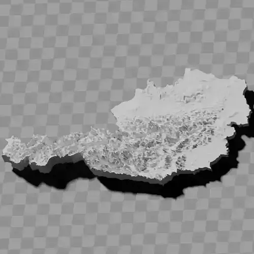
Austria terrain / geography / relief maps
Includes several models:
a cutout with exaggerated terrain / topology [Mercator-projection-distorted version + undistorted version]
simplified version(s) with reduced polygon counts via quadratic decimation
non-cutout versions of the tolopgy [Mercator-projection-distorted version + undistorted version]
a simple 'prism' [flat-surfaced cutout of state boundaries with no topology features added]
'expanded' version which is a convex hull of the prism. You can use this as a 'base' to stabilize the model to avoid problems with small details breaking off if you try to 3d print it.
includes STL and OBJ formats. non-textured.
~~~~~~~~~~~~~~~~~~~~~~~~~~~~~~~~~~~~~~~~~~~~~~~~~~~~~~~
Österreich Gelände- / Geographie- / Reliefkarten
Enthält mehrere Modelle:
ein Ausschnitt mit überhöhtem Gelände / Topographie [Mercator-Projektion-verzerrte Version + unverzerrte Version]
vereinfachte Version(en) mit reduzierter Polygonanzahl durch quadratische Dezimierung
nicht-ausgeschnittene Versionen der Topologie [Mercator-Projektion-verzerrte Version + unverzerrte Version]
ein einfaches 'Prisma' [flacher Ausschnitt der Staatsgrenzen ohne hinzugefügte topologische Merkmale]
'erweiterte' Version, die eine konvexe Hülle des Prismas ist. Sie können dies als 'Basis' verwenden, um das Modell zu stabilisieren und Probleme mit abbrechenden kleinen Details beim 3D-Druck zu vermeiden.
enthält STL- und OBJ-Formate. untexturiert.
REVIEWS & COMMENTS
accuracy, and usability.


