G
2019-12-16 19:24:50 UTCgaf
cool

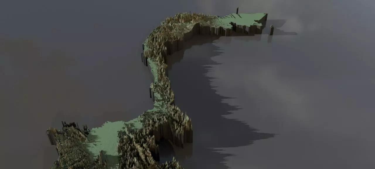
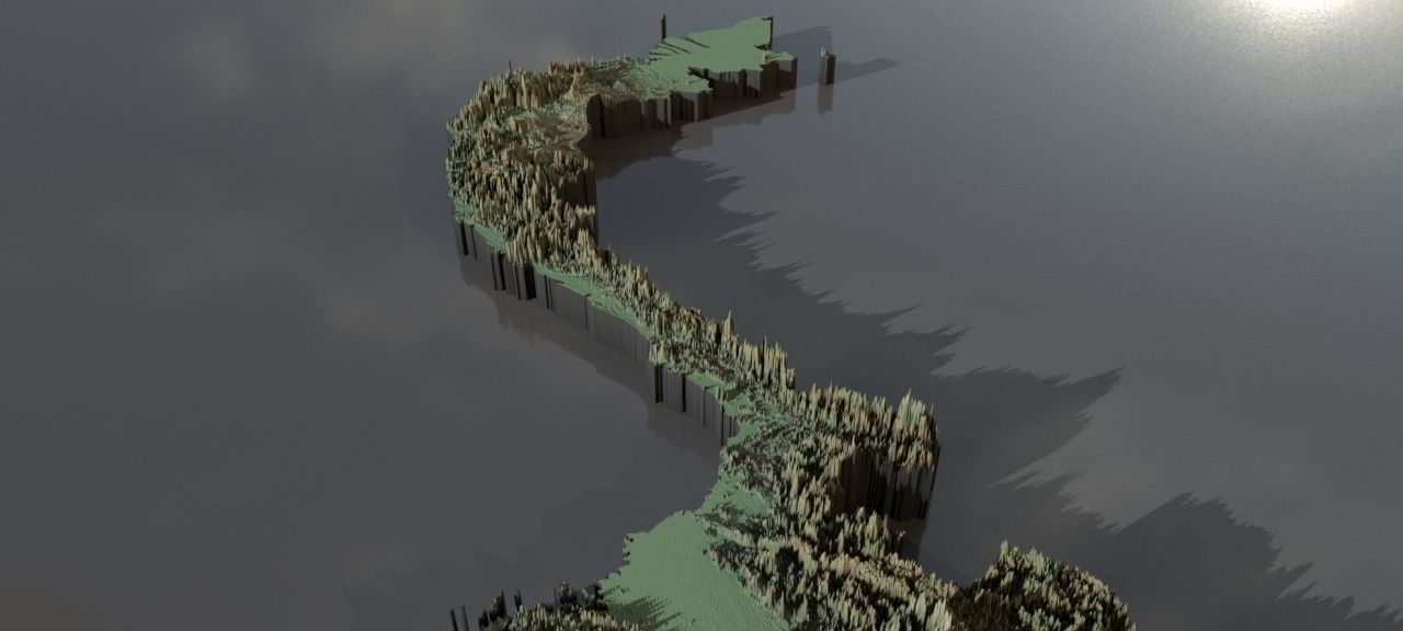
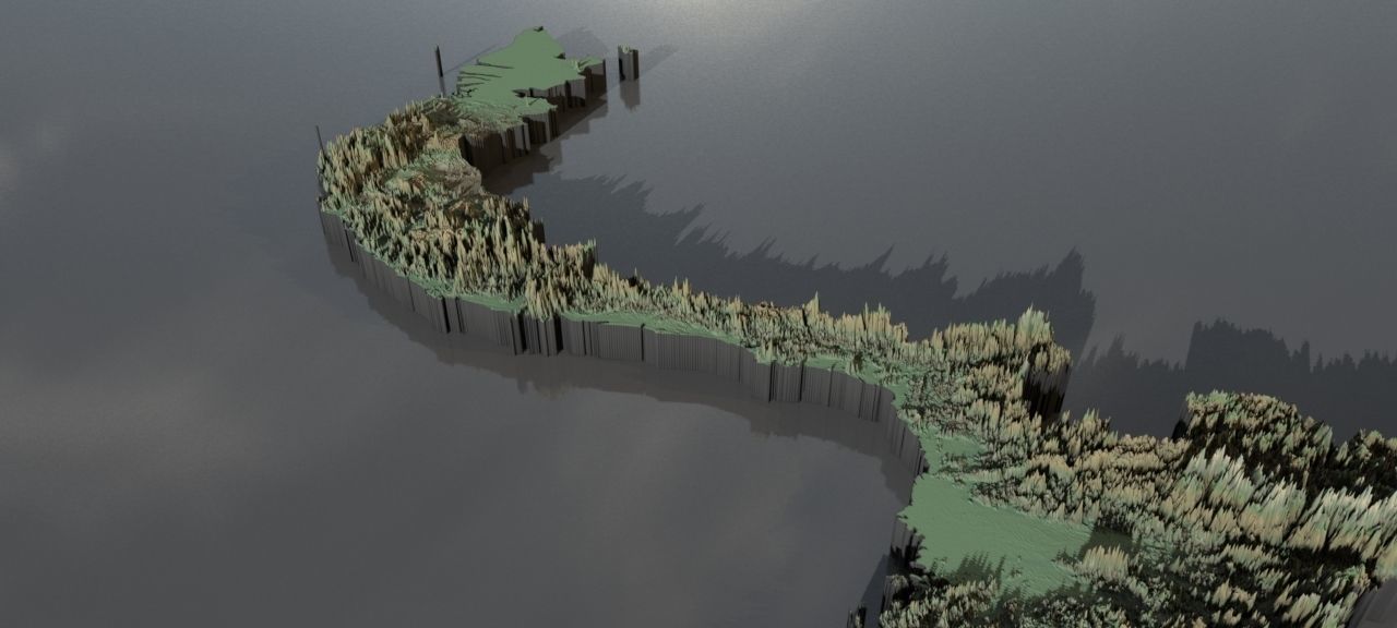
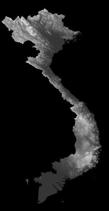
Collection of highresolution heightmaps and geometry for VietNam.(The preview images have boosted heights to make it easier to see and are not the actual height values)
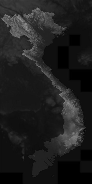
The greyscale values between 0-1 are heightvalues between -100 and 10000 metres.For a proper result the greyscale values should be remapped accordingly.
In the files, LatLon means aligned to the following latitude/longitude coordinates :minimum Latitude :8.0maximum Latitude :24.0minimum Longitude :102.0maximum Longitude :110.0
Cartesian means the latitude/longitude coordinates got mapped onto a earth-sized sphere,then aligned the poles to a grid and brought to the origin. This method should have the least distortion.The other heightmap with longitude/latitude coordinates are on the Mercator projection.
preview0.jpg - resolution :1280x576
preview1.jpg - resolution :1280x576
preview2.jpg - resolution :1280x576
preview3.jpg - resolution :864x1660
preview4.jpg - resolution :819x1638
vietnam_cartesian_heightmap.jpg - resolution :8640x16599
vietnam_cartesian_heightmap_heightmap.exr - resolution :8640x16599
vietnam_cartesian_heightmap_heightmap.jpg - resolution :8640x16599
vietnam_heightmap_latlon_8.0_24.0_8.0_24.0.exr - resolution :
vietnam_heightmap_latlon_8.0_24.0_8.0_24.0.jpg - resolution :8192x16384
tags:heightmap earth longitude latitude world geomapping elevation elevationmap
