DESCRIPTION

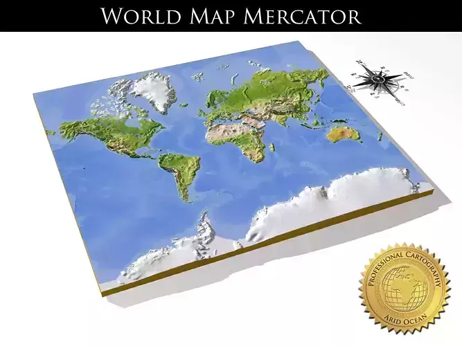
The set contains three models: a 3D relief world map, a separate 3D relief cutout of the land area, and a separate plain cutoutof the land outline.

The map projection is Mercator. Geographic extents: W:-180; E:180; S:-80; N:84.

The 3D relief is taken from reprojected NASA shuttle radar topography data, with the elevation exaggerated. The 3D relief is baked into a 750x641 mesh with 967172 polys, 484996 vertices (for the main map).

An additional 16-bit bump texture is used for fine-grained detail of the 3D relief.

The texture is rendered from color processed NASA satellite images. Included are borders, major cities, rivers and water areas.

Separate b/w texture masks are included for:

  • land/ocean areas
  • rivers and inland water areas
  • cities
  • borders
  • ocean floor depth

A multi-layered material (3ds Max version only) together with the provided texture masks allows extensive changes to the appearance of the 3D relief map.Possible customizations include different colorings or complete removal of separate features like cities or borders.

A description of the multi-layered material and texture masks can be found in the accompanying PDF-manual.

Previews are rendered with mental ray, but the project uses only standard materials.

The .obj and .fbx versions will require new texture assignments after import.
The .obj format is exported as triangles.

The compass rose is included as a bonus.

REVIEWS & COMMENTS

See what other buyers think about this model - real feedback on quality,
accuracy, and usability.
View all
1
0
3
pl
plan-systemsBuyer of this model
This user has purchased this specific model
Great work. Love these maps! The developer was very responsive and helpful with delivering exactly what was needed for my project.
na
nanda-sumedangCommunity member
This user is part of the CGTrader community
Nice
pe
petterwannerbergBuyer of this model
This user has purchased this specific model
Hello ! This looks nice and I'm looking to buy it for a project im doing but have a couple of questions. - Are the texture files for the height data included? I'm looking to mask in in Unity so need full control of the height map. - Are the country lines and cities possible to remove (seperate textures) or are they baked into the diffuse? I need an as clean map as possible since were doing a timeline dating back to before cities and a lot of countries existed. Thank you for a fast reply! This looks like nice work so I hope I can use it.
Asset-Store
Asset-StoreCommunity member
This user is part of the CGTrader community
Nice
BEST PRICE GUARANTEED
Found this model cheaper on another marketplace? Let our support team know - we’ll match it.

WorldMercator High resolution 3D relief maps 3D model

Royalty Free License
Hire
Like this model to show appreciation to the designer.
See how many times this model was viewed.
Share this model to support the designer and boost their visibility.
Native file format
MAX3 files
Size: 43.6 MB
2013
2013
2013
Exchange formats
OBJ
OBJ | 3 files<br />File Size: 29.5 MB
FBX
Autodesk FBX | 3 files<br />File Size: 40 MB
PDF
PDF<br />File Size: 412 KB
Provided by designer
Information and details shared directly by the model's designer.
3D Features
The model includes animations (movement or actions) that can be played in supported software or engines.
The model has a skeleton or bone structure, making it ready for posing or animation.
PBR
Uses Physically Based Rendering materials, which give the model realistic lighting and surface properties.
Textures
The model includes image files (textures) that add color, patterns, or detail to its surfaces.
Materials
The model has material settings that define how surfaces look (color, shine, transparency, etc.).
UV Mapping
The model's surfaces are mapped to a 2D image, allowing textures to display correctly.
Plugins Used
Some external plugins were used to create the model. These may be required for full functionality.
3D printing
Indicates whether the designer marked this model as suitable for 3D printing.
Model is not 3D printable
The designer indicates this model is intended for digital use only (rendering, animation, or AR/VR) and not for 3D printing.
Geometry
Polygon mesh
A model built from polygons (triangles or quads) connected in a mesh.
967172 polygons
The total number of polygons (flat shapes) that make up the 3D model.
/ 484996 vertices
The number of points (corners) that define the shape of the model's polygons.
Unwrapped UVs
Publish date
Model ID
Chat