1/14
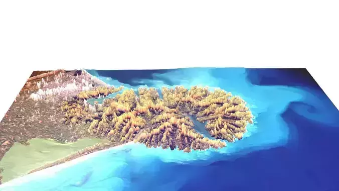
DescriptionBanks Peninsula. Banks Peninsula (Māori: Te Pātaka o Rākaihautū) is a peninsula of volcanic origin on the east coast of the South Island of New Zealand. It has an area of approximately 1,200 square kilometres (450 sq mi) and encompasses two large harbours and many smaller bays and coves. The South Island's largest city, Christchurch, is immediately north of the peninsula. Banks Peninsula forms the most prominent volcanic feature of the South Island, similar to — but more than twice as large as — the older Dunedin volcano (Otago Peninsula and Harbour) 350 kilometres (220 mi) to the southwest. Geologically, the peninsula comprises the eroded remnants of two large composite shield volcanoes[clarification needed] (Lyttelton formed first, then Akaroa), and the smaller Mt Herbert Volcanic Group. These formed due to intraplate volcanism between approximately eleven and eight million years ago (Miocene) on a continental crust. The peninsula formed as offshore islands, with the volcanoes reaching to about 1,500 m above sea level. Two dominant craters formed Lyttelton and Akaroa Harbours. The Canterbury Plains formed from the erosion of the Southern Alps (an extensive and high mountain range caused by the meeting of the Indo-Australian and Pacific tectonic plates) and from the alluvial fans created by large braided rivers. These plains reach their widest point where they meet the hilly sub-region of Banks Peninsula. A layer of loess, a rather unstable fine silt deposited by the foehn winds which bluster across the plains, covers the northern and western flanks of the peninsula. The portion of crater rim lying between Lyttelton Harbour / Whakaraupō and Christchurch city forms the Port Hills.
Texture Resolution: 1920 x 1275
REVIEWS & COMMENTS
accuracy, and usability.


