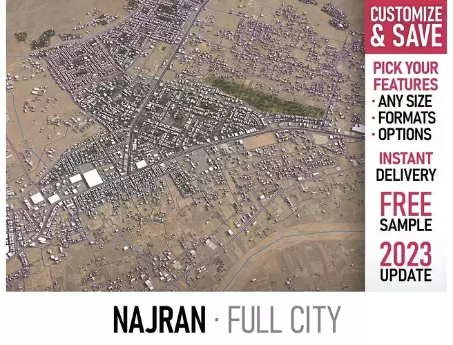
DESCRIPTION
  • TRY BEFORE YOU BUY
    • Message us to get a FREE sample scene of this product!
    • Download an overview sample - www.each.city/sample
  • WHAT IS INCLUDED
    • DETAILS
      • Scene size: Entire area — refer to promo images for scene extents
      • Units: Meters — real-world scale
      • Updated: August 2023 — want the latest? Ask before you pay
    • KEY BENEFITS
      • 24/7 customer support — reach out to us anytime for pre-sale inquiries or after-sale support
      • Extensive file format support — 3ds Max (native), fbx, obj, dae, c4d, skp, 3dm, rvt, blend, etc., or ask for more before payment
      • Georeferencing — either Web Mercator, Transverse Mercator, or original CRS. If a specific CRS is essential, ask before you pay
      • Any scene size or crop to an area-of-interest — for best performance and format compatibility, inquire before paying
      • Buildings, land-use areas, roads and railways split by type — layers / named objects
      • Detailed landmarks with regular updates and improvements — available annually or upon pre-purchase inquiry
      • Realistic and detailed surface texture — 1-meter resolution satellite imagery
      • Flat surface, easy for detailing and geometry edits — topography terrain available at an additional cost. Message us for a quote
      • Realistic low-poly vegetation — individual trees in max and fbx formats, additional formats upon request before you pay
      • Product is ready to render out-of-the-box — 3ds Max + Corona Render
    • PRESENTATION IMAGES
      • 4K high-resolution renders — refer to images for level of detail and scene size
      • Produced in 3ds Max — other software requires its rendering settings
    • MATERIALS
      • Trees, vegetation, land-use and airport surface with the textures assigned
      • Buildings are UV mapped, split by material IDs, and no textures assigned
  • CUSTOMIZE & SAVE
    • TERMS & CONDITIONS
      • Only applies to new customers who placed an order through the HIRE ME option
      • Fully customizable model based on the options listed below
      • Fast turnaround, flexible pricing and discounts
    • SCENE SIZE
      • Full city extents up to 100 x 100 km — or crop to an area of interest for better format compability and scene performance
      • Extended area up to 1000 x 1000 km — or any size options or slice to tiles
    • DATA AUTHENTICITY
      • 100% real buildings coverage — unlike other sellers, we don’t use AI generated building footprints
      • Combining multiple sources — you may povide us with any dataset to include in the model
    • GEOREFERENCING
      • Coordinate Reference Systems (CRS) - available options
        • Web Mercator — specified by true scale latitude
        • Transverse Mercator — defined by central meridian
        • Original CRS — local or optimal for this area
      • Geolocation — allows you to precisely position 3D content at any specified latitude and longitude
    • TOPOGRAPHY TERRAIN
      • Up to 1-meter accuracy digital terrain model (DTM) — quad mesh
      • Multiple terrain LODs — triangle mesh optimized for the best polycount / details balance
      • Buildings and roads placed on the optimized terrain
      • Separate land surface and water bodies
      • High-resolution satellite or surface texture — up to 0.2 meter accuracy
      • Contour lines — 3D splines, up to 1-meter interval
    • MANUAL MODELING
      • Buildings and structures — LOD2 and LOD3
      • Elevated highways — interchanges, bridges and flyovers
    • TEXTURING
      • High-resolution surface texture — satellite image up to 0.2 meter accuracy
      • Streets and roads with markings texture — UV mapped along the center line
      • Procedural textures assigned to all buildings — LOD1 only
      • Realistic textures on individual buildings — LOD2 and LOD3
    • TREES & FORESTS
      • Individual trees — real trees from OSM data
      • Procedural forests — based on distribution areas, convertible to individual trees
    • OTHER EXTRAS
      • Individual buildings and streets — separate objects with address and/or name
      • Administrative boundaries of all levels — named polygons or outlines
      • Road and railway splines — for traffic animation, etc.
      • Public transport stops — individual named objects
    • FILE FORMATS
      • max — Autodesk 3ds Max
      • fbx, obj, dae, 3ds — Exchange Formats
      • uproject, uasset — Unreal Engine
      • glb, gltf — Games, Web, AR/VR
      • unitypackage — Unity 3D
      • 3dm — Rhino 3D
      • skp — SketchUp
      • rvt — Autodesk Revit
      • c4d — Cinema4D
      • blend — Blender
      • ma, mb — Autodesk Maya
      • dwg, dxf — Autodesk AutoCAD
      • stl — 3D Print
  • NOTICE
    • Options within the CUSTOMIZE & SAVE section are exclusively available through the HIRE ME option. Flexible pricing applies

REVIEWS & COMMENTS

See what other buyers think about this model - real feedback on quality,
accuracy, and usability.
There are no reviews or comments yet. Please be the first one to write it.

Najran - 3D City Model Low-poly 3D model

Royalty Free License
Like this model to show appreciation to the designer.
See how many times this model was viewed.
Share this model to support the designer and boost their visibility.
Native file format
MAX6 files
Size: 53.8 MB
Exchange formats
BLEND
Blender | 2 files<br />File Size: 16.2 MB
OBJ
OBJ | 2 files<br />File Size: 18.7 MB
FBX
Autodesk FBX | 4 files<br />File Size: 70 MB
C4D
Cinema 4D | 2 files<br />File Size: 23 MB
MA
Autodesk Maya | 2 files<br />File Size: 16.2 MB
GLTF
glTF | 2 files<br />File Size: 16.2 MB
DWG
AutoCAD | 2 files<br />File Size: 10.2 MB
FBM
fbm | 2 files<br />File Size: 23 MB
PDF
PDF | 2 files<br />File Size: 16.2 MB
3DM
Rhinoceros 3D | 2 files<br />File Size: 16.2 MB
3DS
3D Studio | 2 files<br />File Size: 16.2 MB
DAE
Collada | 2 files<br />File Size: 16.2 MB
DXF
DXF | 2 files<br />File Size: 16.2 MB
LS10
Lumion | 2 files<br />File Size: 16.2 MB
RFA
Autodesk Revit | 2 files<br />File Size: 16.2 MB
SKP
Sketchup | 2 files<br />File Size: 16.2 MB
STL
Stereolithography | 2 files<br />File Size: 16.2 MB
UASSET
UnrealEngine | 2 files<br />File Size: 16.2 MB
UNITYPACKAGE
Unity 3D | 2 files<br />File Size: 16.2 MB
Verified by CGTrader
Verified models are of higher quality as they have
passed CGT Standard technical and visual checks,
making them more professional-grade 3D assets.
Learn more.
FBX
This FBX file has successfully passed the CGT Standard technical and visual checks. The verification results are detailed in the section below.
File & scene
Binary FBX
Binary FBX file is more compact and faster to load and process.
Learn more
No unsupported objects
Unsupported objects:
- Lights
- Cameras
Learn more
Geometry
No N-gons
N-gons are polygons with five or more sides which might cause issues in certain processes like rendering or animation. Learn more
No faceted geometry
Faceted geometry uses flat surfaces without smoothing, which can look unrealistic on curves.
Learn more
Manifold geometry
Manifold geometry ensures all surfaces are properly connected, avoiding issues like edges shared by more than two faces.
Learn more
Textures & material
PBR textures
PBR textures simulate how light interacts with materials, making the model look realistic under different lighting.
Required PBR textures:
- Base Color
- Roughness
- Metalness
- Normal
Learn more
No embed textures
Embedded textures are stored inside the model file, increasing its size and sometimes causing compatibility issues.
Learn more
Square textures
Texture aspect ratio is the width-to-height ratio of a texture. Expected texture aspect ratio: 1:1
Learn more
Power of 2 texture sizes
Textures with dimensions in power of two (e.g. 512x512px, 1024x1024px) are used to optimize performance and memory usage.
Learn more
Assigned materials
Materials are applied to the 3D model to allow visualize a model's surface properties and appearance.
Learn more
UVs & naming
No UV overlaps
UVs overlap when multiple points on the 3D model's surface are mapped to the same point on the UV island causing texture stretching.
Learn more
UV unwrapped model
A UV unwrapped model means its 3D surface is flattened into 2D space, allowing textures to be applied accurately.
Learn more
Allowed characters
Allowed ASCII characters: a-zA-Z0-9-_
Learn more
Provided by designer
Information and details shared directly by the model's designer.
3D Features
Animated
The model includes animations (movement or actions) that can be played in supported software or engines.
Rigged
The model has a skeleton or bone structure, making it ready for posing or animation.
Low-poly
PBR
Uses Physically Based Rendering materials, which give the model realistic lighting and surface properties.
Textures
The model includes image files (textures) that add color, patterns, or detail to its surfaces.
Materials
The model has material settings that define how surfaces look (color, shine, transparency, etc.).
UV Mapping
The model's surfaces are mapped to a 2D image, allowing textures to display correctly.
Plugins Used
Some external plugins were used to create the model. These may be required for full functionality.
3D printing
Indicates whether the designer marked this model as suitable for 3D printing.
Model is not 3D printable
The designer indicates this model is intended for digital use only (rendering, animation, or AR/VR) and not for 3D printing.
Geometry
Polygon mesh
A model built from polygons (triangles or quads) connected in a mesh.
1 polygons
The total number of polygons (flat shapes) that make up the 3D model.
/ 1 vertices
The number of points (corners) that define the shape of the model's polygons.
Unwrapped UVs
Publish date
Model ID
Hire
Chat