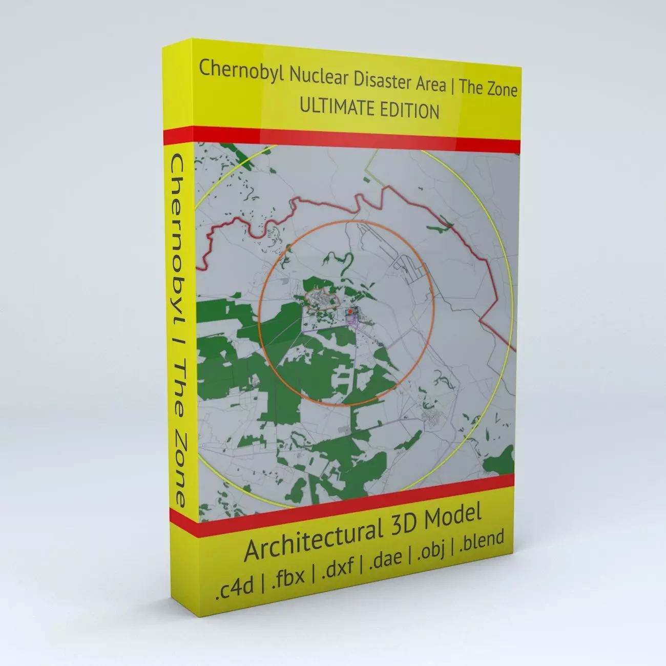
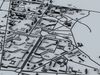
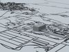
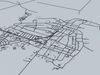
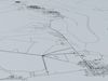
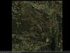
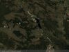
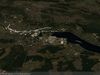
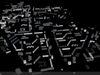
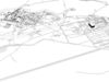
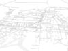
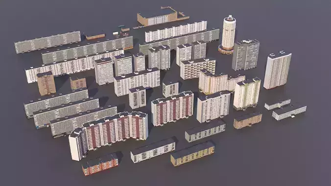
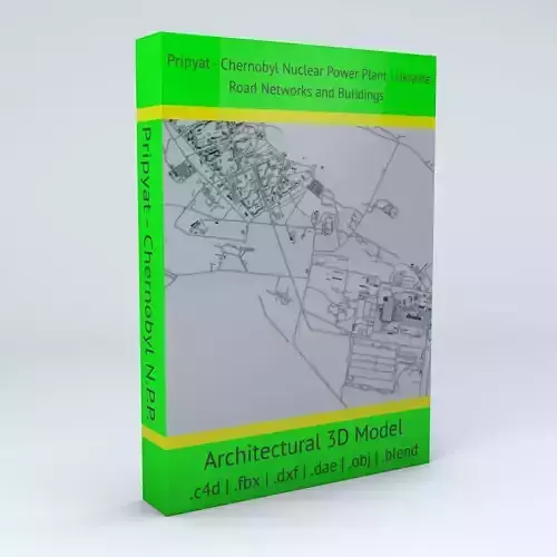
- Chernobyl Disaster Area | The Zone Ultimate Edition 3D model is based on real data therefore this is a realistic buildings and streets setup of the Chernobyl Disaster Area, Ukraine (at the time of the accident Soviet Union in April 26, 1986)
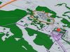
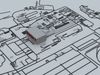
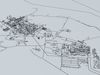
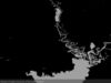
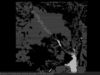
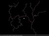
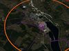
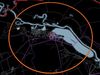
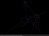
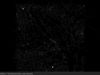
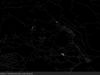
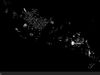
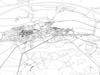
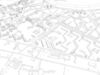
- this 3D model covers a more than 100kmx100km (10000 sqkm) / 62milesx62miles (3860sqmiles) area of the Chernobyl/Chornobyl Nuclear Disaster Area/Zone including road networks, streets and buildings of Pripyat/Prypyat, the nuclear power plant site, the town of Chernobyl/Chornobyl and the surrounding areas
- 5 building groups are setup so that you can add variety to buildings (color materials and/or textures) Groups can be turned off/on
- 3D models are UV mapped with overlapping UVs except the terrain textures that have non-overlapping/unwrapped UVs
- the model is positioned on a flat surface (all buildings are on the “floor” - no elevation data included)
- geometry is polygonal quads and tris
- materials included for better distinctioning
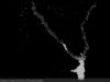
- 3 terrain textures included – 1. colored terrain textures 5700x5700 (32.49MP) - for distance (satellite type) renders 2. B&W water resources map texture 3600x3600 (12.96MP) - for distance renders 3. B&W natural resources incuding water texture 20000x20000 (400MP) - high details ad good for closeup renders
- black and white (B&W) textures can be made trasparent so that you can overlay the terrain texture if you wish
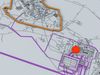
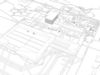
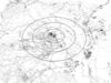
- reactor 4 text 3d model included
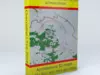
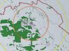
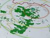
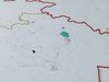
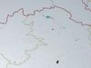
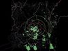
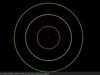
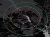
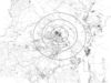
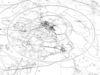
- 10km / 20km / 30km circles and the epicenter of the explosion are included
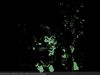
- other areas (green on preview renders) including forestry, infrastructure and other areas are included
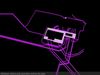
- power lines and power stations (purple in the preview images) in/out the power plant are included
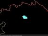
- UKR BEL border (red), in country state borders, Pripyat city administrational area border (orange) and Pripyat area (light blue) are included
A malfunction, derived from an emergency test in the Vladimir Iljich Lenin (Chernobyl/Chornobyl) Nuclear Power Plant, resulted core overheating that lead to the explosion of Reactor 4. The explosion dispersed vast amount of radioactive materials around the area making it uninhabitable. The evacuation of the city of Pripyat/Prypyat started after 36 hours after the accident because of high radiation level.
- this 3D model is/can be licensed (commercial use is fine) under Creative Commons Attribution-ShareALike 2.0 (CC-BY-SA) license
- buildings and streets data from OpenStreetMap / www.openstreetmap.org
Attribution : © OpenStreetMap contributors / CC BY SA 2.0 http://www.openstreetmap.org/copyright
POINTS/VERTS : 962134POLYGONS : 875695
- .c4d - native format
- .fbx - v7.1
- .dae – v1.5
- .dxf
- .obj
- .blend
————————————————————————————————————————————————————————
Extra description is to avoid any misunderstanding with the 3D model
————————————————————————————————————————————————————————
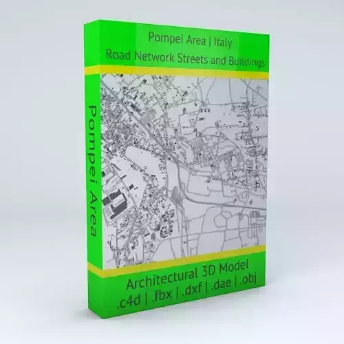
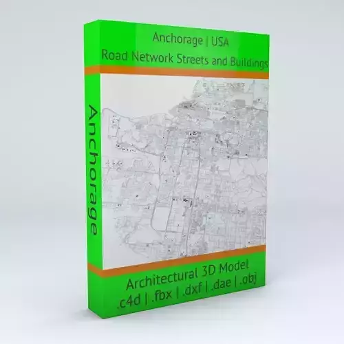
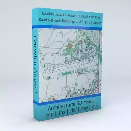
The “streets” in the title means the area between the buildings. It is not a separate 3D model. There are other models available called “XYZ” Road Network and Streets where the streets are actual 3D models (“XYZ” is just an example and substitutes a real city/area name). You can check the details of every model by watching the preview images. You’ll get exactly that 3D model on purchase which you see on the preview images.
Please note, that although the model reflects reality there might have buildings missing if there is no data available for certain parts of the city depending on the degree of data processing. Missing parts might be available later and if it happens an update will come to the model. If you purchased the model all updates come with no extra cost.Also there might be buildings already on the map which they don’t even exist yet due to urban planning projects regarding to the future.Same concept of this point applies to any terrain 3D model if it comes with this model.
Those 3D models are compatible with each other (they match by a simple copy and paste command) where the description includes this kind of information. Compatibility added continuously over time. If you need a “XYZ”Streets and Buildings and a “XYZ” Road Network 3D model of the same city/area but they are not compatible, please contact for availability. Usually this kind of request can be prioritised.
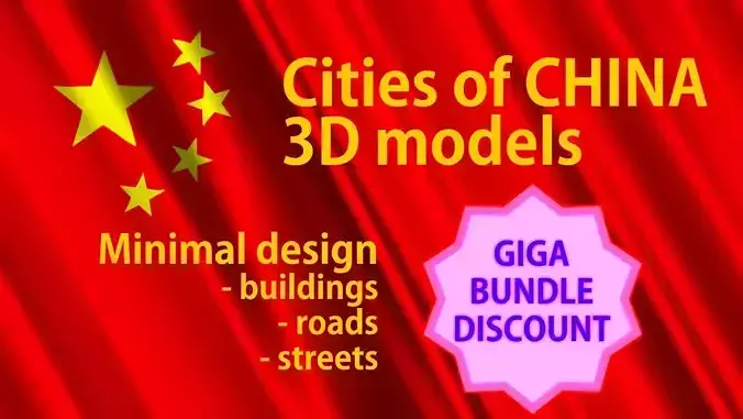
These models are designed to show and present the city/area in the title in a minimalistic concept. They show a close to exact streets and buildings alignments and building heights (excluding parts where there is no or insufficient data to build 3d geometry) therefore they can be used for many purposes but they are not designed to build ie. high precision urbanscape.
These models are not 3D print ready.
On purchase, you’ll receive exactly the 3D model that you see on the preview images. Lighting setup isn’t included so you can render the model in your scenes or you can download a free render studio for the city 3D models in .c4d (native format) and .fbx (exchange format). The.c4d is basically ready to render. In the .fbx and/or .dae files the light parameters/details should be setup in your 3D software.
Free render studio download : https://www.cgtrader.com/free-3d-models/various/various-models/render-studio-for-cinema-4d
——————————————
Please, make sure that the model will suit to your project by checking the preview images and 3D Model description. If you’re unsure or have doubts, please ask before purchase and your questions will be answered precisely.
——————————————
The City Project by boscorelli3D - www.boscorelli.net