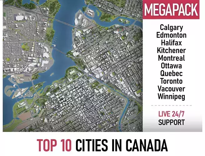
Collection of the Top 10 Canadian cities with the surrounding area based on GIS data (May 2020)
The only product on the market with 100% 3d buildings coverage from 12,663,475 buildings footprint polygon geometries in all canadian provinces and territories
- Projections: Transverse Mercator
- File units: Meters
COLLECTION
- Calgary
- Edmonton
- Halifax
- Kitchener
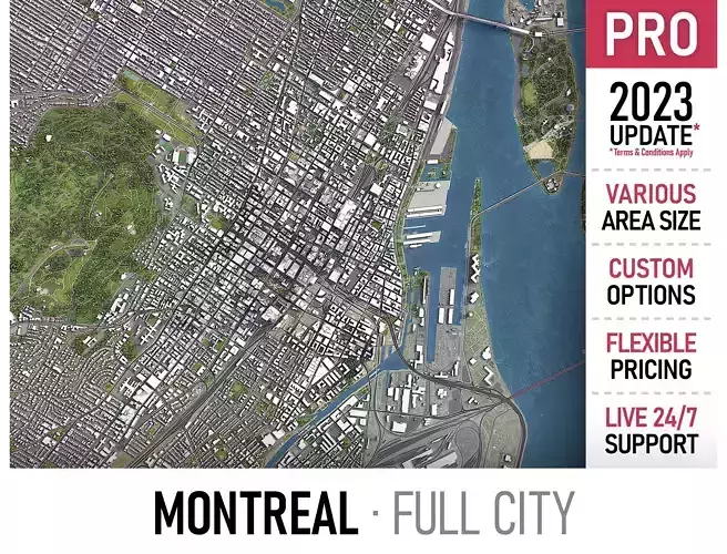
- Montreal
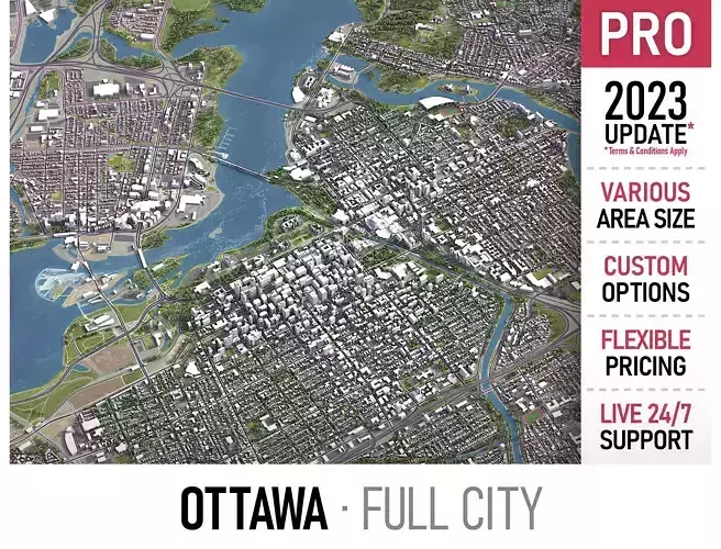
- Ottawa
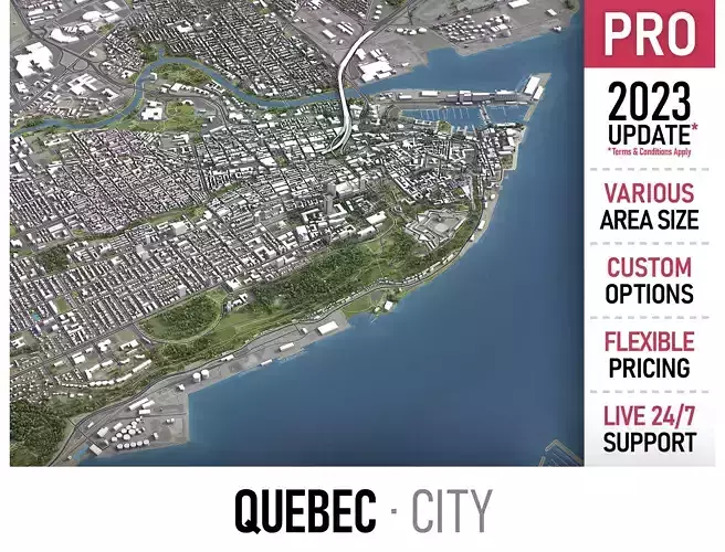
- Quebec
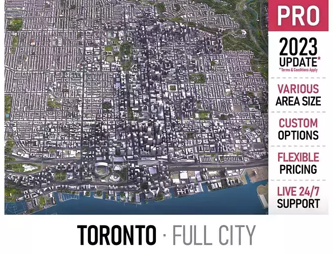
- Totonto
- Vancouver
- Winnipeg
PRODUCT INFO
- KEY BENEFITS
-
Live 24/7 support (format conversion, software adjustment, area cropping, etc.)
- This 3D city model is georeferenced, exact and accurate to real-world scale
- Buildings, landuse areas, roads and railways split by type (see scene structure)
- The surface is flat, easy to add details and edit geometry (terrain on request)
- Realistic low-poly trees and forests
- EXTRAS (on request)
- Administrative boundaries of all levels (named polygons or outlines)
- Road and railway splines for traffic animation
- Public transport stops with names
- PRESENTATION IMAGES
- Product is ready to render out-of-the-box (3dsmax + corona renderer)
- 4K high-resolution realistic renderings (refer to images for level of detail)
- MATERIALS
- Buildings are UVW mapped, split by material IDs, no textures assigned
- Trees, vegetation, landuse and airport surface with the textures assigned
SCENE STRUCTURE - model is organized by layers, all objects split by type and named properly
- BUILDINGS
- residential
- commercial
- industrial
- public
- sports
- parkings
- transport
- ROADS
- highways
- primary
- secondary
- tertiary
- residential
- service
- RAILWAYS
- train
- city tram
- subway
- monorail
- PAVEMENT
- sidewalk
- footway
- cycleway
- LANDUSE
- residential
- public
- industrial
- construction
- agriculture
- VEGETATION
- forest
- grass
- scrub
- park
- garden
- cemetery
- recreation
- NATURAL
- AIRPORT
- building (terminal, gates)
- apron
- taxiway
- runway
SUPPORT - please send us a message 24/7
-
FREE - Product update with the latest GIS data
-
$299+ - Request any other city or area (same day delivery)
-
$199+ - Add terrain based on SRTM or LIDAR elevation data (3-5 LODs optimized)