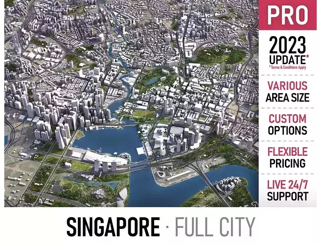
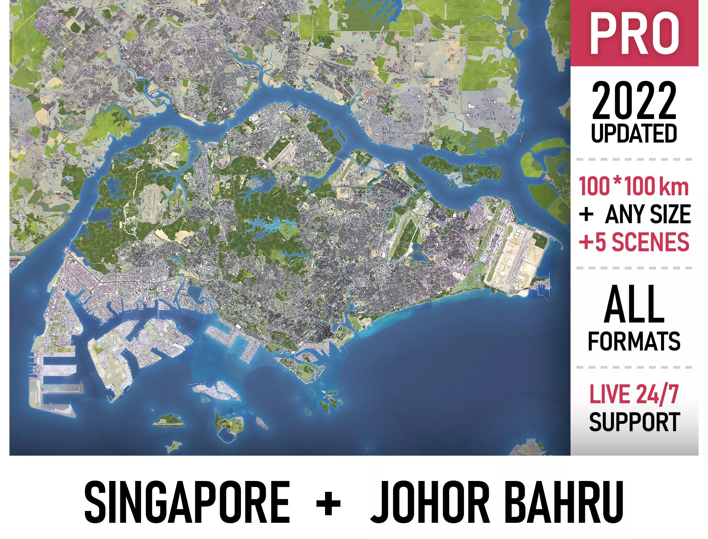
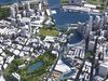
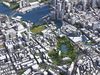
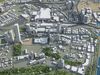
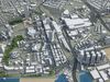
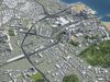
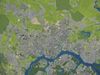
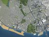
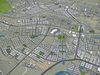
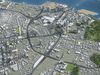
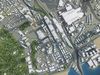
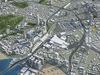
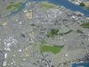
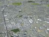
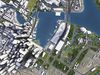
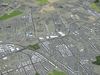
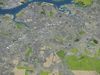
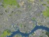
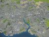
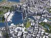
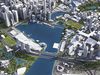
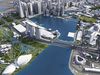
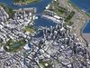
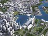
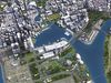
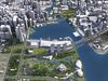
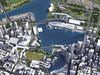
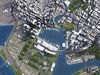
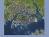
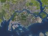
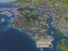
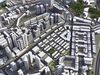
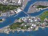
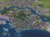
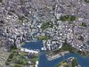
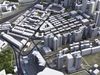
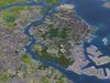
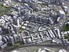
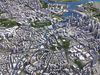
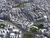
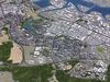
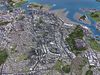
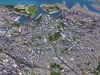
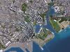
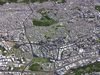
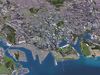
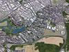
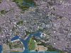
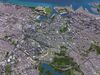
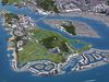
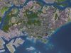
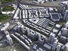
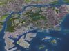
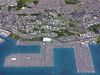
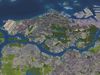
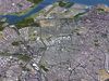
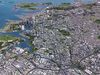
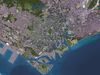
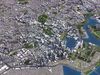
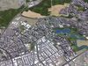
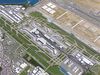
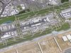
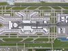
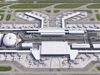
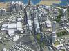
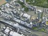
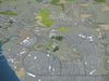
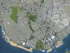
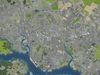
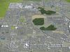
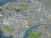
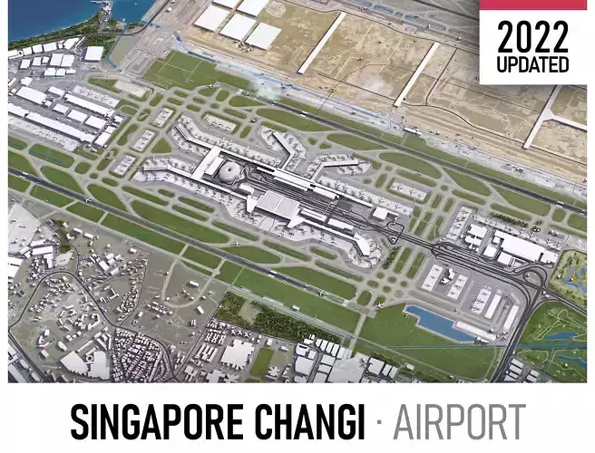
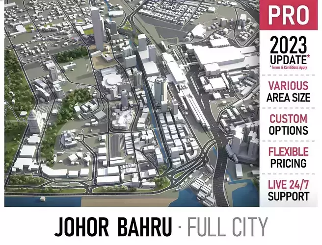
This is exact and accurate to scale 3D city model of Singapore - Johor Bahru Metropolitan area based on GIS data (February 2022)
- File units: Meters
- Scale: 1:1
PACKAGE CONTENTS
- This collection includes 3 scenes of different size
-
100 x 100 km - Complete scene
-
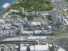
80 x 40 km - Johor Bahru
-
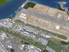
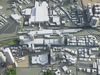
60 x 50 km - Singapore city extents (incl. airport)
-
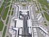
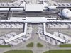
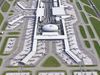
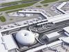
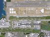
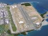
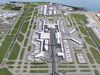
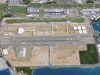
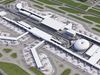
15 x 15 km - Singapore Changi Airport (SIN)
-
You may request any specific area crop (prior to the purchase)
- File formats (software supported)
-
MAX - Autodesk 3dsMax
-
FBX, OBJ, DAE - Exchange Formats
-
GLTF, GLB - Games, Web, AR/VR (request)
-
UNITYPACKAGE - Unity 3D
-
3DM - Rhino 3D
-
SKP - SketchUp
-
RVT - Autodesk Revit (request)
-
STL - 3D Print (request)
-
C4D - Cinema4D
-
BLEND - Blender
-
MA, MB - Autodesk Maya
-
DWG, DXF - Autodesk AutoCAD
BASIC OPTIONS (included with the purchase)
- KEY BENEFITS
- 24/7 customer support
- Regular updates and improvements
-
100% buildings coverage from buildings footprint polygon geometries in all 50 U.S. States
- Buildings, landuse areas, roads and railways split by type (layers / named objects)
- The surface is flat, easy to add details and edit geometry (terrain on request)
- Realistic low-poly trees and forests (max, fbx included, other formats on request)
- Product is ready to render out-of-the-box (3dsmax + corona renderer)
- PRESENTATION IMAGES
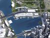
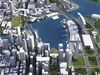
- 4K high-resolution realistic renderings (refer to images for level of detail or request close-ups)
- Rendered in 3dsMax (other software requires its own rendering settings)
- MATERIALS
- Trees, vegetation, landuse and airport surface with the textures assigned
- Buildings are UVW mapped, split by material IDs, no textures assigned
CUSTOM OPTIONS (available at a special price - please request before buying)
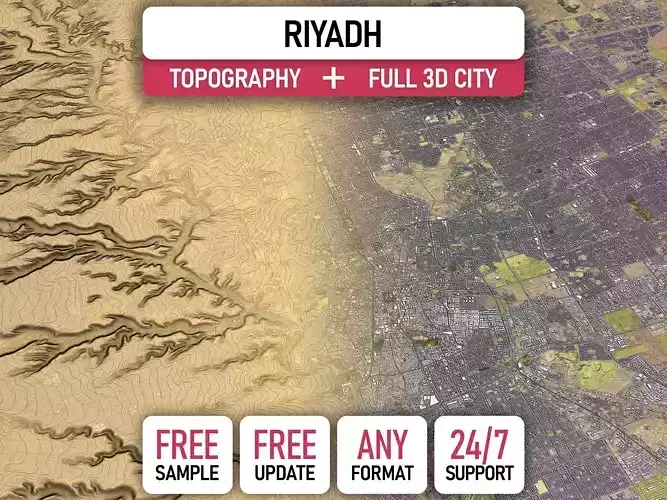
- TOPOGRAPHY TERRAIN
- Up to 1 meter accuracy raw terrain object (USGS 3D Elevation Program)
- Multiple LODs optimized for the best polycount/details balance
- Contour lines (up to 1 meter interval)
- High-resolution (up to 20cm accuracy) satellite or surface texture
- Buildings and roads placed on the optimized terrain
- OTHER EXTRAS
- On-demand custom update
- Crop to custom area size or slice to tiles
- Procedural textures assigned to all buildings
- Individual buildings and streets (with address and/or name)
- Administrative boundaries of all levels (named polygons or outlines)
- Road and railway splines for traffic animation
- Public transport stops with names
CONTACT US
- Discounts
- 24/7 customer support
- Custom and on-demand options
- Adjustments and improvementsmized)