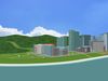
Amaryllis City is a city located on the eastern part of central Oranova. The city’s center is connected by two land routes and one water route. To the north is Route 6, which leads to Hydrangea City. Also known as the Foothills Scenic Trail, this route takes you on a winding path across rocky outcrops on sloping terrains higher than the Lycoris Hills. To the southwest is Route 5, which leads to Camellia City. This route is known as the Lycoris Hills Greenway, and goes through a range of tree covered hills with great views of the surrounding area. To the east of the city is Route 14, a water route that goes across the Calendula Bay to Bouvardia Town. This route is known as the Calendula Bay Link.
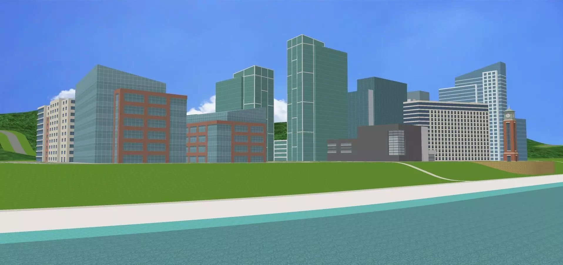
Originally a rural area with many orchards, Amaryllis City has moved on to become a major commercial center, due to the influx of technology companies coming into central Oranova, which has brought many new office buildings and hotels to its landscape. This has caused the city to be the center for urban sprawl, and is increasingly growing each year. The city also features many gardens and plazas for recreation and relaxation. Amaryllis lies within a unique location, as it is surrounded by the rolling forest covered Lycoris Hills, which provide nature walks and hiking trails for tourists and travelers. On the shores of the Calendula Bay are Amaryllis Bluffs, vistas and cliffs that provide breath taking views of the area. It's all here waiting for you to explore!
Places of Interest in Amaryllis City
Amaryllis Arboretum
The Amaryllis Arboretum is an arboretum and botanical garden located on the southern part of the city. The arboretum contains over 200 species of trees, shrubs, flowers, and herbs, and includes nature walks and hiking trails.
Amaryllis City Music Center
The Amaryllis City Music Center, better known by locals as simply the A.C.M.C., is a 3,850–seat live music venue that is well known hosting over 100 concerts a year. It also serves as the home for television music programs such as Amaryllis City Limits, a long-running concert series that celebrates the various genres of music found across Oranova. Amaryllis City Philharmonic is also headquartered here and is symphony orchestra that brings classical and epic music into the 21st century.
Amaryllis Visitors’ Center
The Visitors’ Center provides great information about the history and geography of Amaryllis City and its vicinity. There are plenty of interactive exhibits to attract and engage tourists about the area.
Amaryllis Square
Amaryllis Square is a public square that has many events and interactive activities such as outdoor movies, concerts, outdoor dining, and farmer's markets.
Amaryllis Bluffs Regional Park
Amaryllis Bluffs Regional Park is an Oranova Regional Park located east of Amaryllis City, along the shores of the Calendula Bay. The park has nature trails down the cliffs to the water, along with wonderful vistas and close-up views of the bluffs. Each year, millions of tourists come to the Amaryllis Bluffs to admire their beauty and natural setting. The beaches at the foot of the bluffs are of an elegant white color.
Consisting of small quartz and granite particles, this sand came from a process involving the Aralia Mountains and the Calendula River 20,000 years ago. At the end of the last Ice Age, when the temperatures began warming and the ice caps began melting, large volumes of water were carried by the rivers to the world’s oceans. The Calendula River, rising in the Aralia Mountains, carried that water to the Gulf of Oranova and continues today. This process has happened for thousands of years, and the river has expanded and widened to the point of forming a large estuary, now known as the Calendula Bay.
This water carried the granite and quartz particles from the rock that forms the Aralia Mountains and deposited them in the Gulf of Oranova, several miles to the north of what is now Amaryllis City. As the sea level began to rise, these quartz sands eventually formed a new shoreline, and because of this, the sands continually get replenished each year.
Amaryllis Point
Included in the park is Amaryllis Point. This is one of the three geographical points along a large headland in central Oranova. Of all them, Amaryllis Point is the highest, being 36 feet above sea level. There is a trail in the adjacent Amaryllis Arboretum that provides great views of the area.
Amaryllis Carillon Tower
The Amaryllis Carillon Tower is a 155-foot-tall carillon-clock tower that is included in the Amaryllis Bluffs Regional Park. The tower and carillon was recently built, and is a popular destination for tourists in Amaryllis City. It has 62 bells and a range span of 5 octaves. The carillon chimes each quarter of the hour from 8 A.M. to 8 P.M. with many different tunes being played at various times of the day. It is located on top of a large stone wall that overlooks the Calendula Bay.
Lycoris Hills Regional Park
Lycoris Hills Regional Park is an Oranova Regional Park located to west of Amaryllis City. The park covers most of the gently rolling hills, which remain an important part of central Oranova’s physical geography. Many Pokémon call this park their home, and it acts as an ecoregion for them. The park offers nature walks and hiking trails along rolling hills, ravines, and gullies covered by subtropical coniferous forest, with a few streams running through parts of the area.
The highest point in the Lycoris Hills is Overlook Hill at 480 feet above sea level, located halfway between Camellia City and Amaryllis City. The summit is also located right next to Route 5. In the Amaryllis area, the highest point in the range is Amaryllis Hill at 426 feet above sea level, located south of Route 5, with the Amaryllis Arboretum right at the foot of it.
In the northernmost parts of the range, the Lycoris Hills start transitioning into the Foothills of the Aralia Mountains. Unlike the low-lying hills in the south, these hills have more rockier terrain, with plateaus, gorges, and waterfalls occurring throughout this area. The Foothills help form the lowest segment of the Aralia Mountains, the largest mountain range in east Oranova.
Unlike most cities, Amaryllis City is more of a mid-sized city, and represents more of a town center or lifestyle center, with its master-plan-like design. We hope you enjoy this model, and feel free to download it and leave a like!