1/14
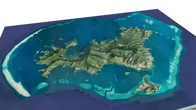
Mayotte islands 3d model terrain. 3d model archipelago of Mayotte with its landscape of mountains, beaches and forests.
3d model landscape of Grande-Terre island, Mayotte islands, Indian Ocean, French.High Poly meshHigh detailed model
with 10K textures
- Diffuse map
- AO map
- Displacement map
- Normal map
- Roughness map
The Blend file do not require the displacement, but you can still use it if you want to create other island model yourself
Texture example from Grande-Terre island, Mayotte islands, Indian Ocean, French. Mayotte is an archipelago in the Indian Ocean between Madagascar and the coast of Mozambique. It’s a department and region of France, though traditional Mayotte culture is most closely related to that of the neighboring Comoros islands. The Mayotte archipelago is surrounded by a coral barrier reef, which shelters a lagoon and marine reserve that are popular diving destinations.
REVIEWS & COMMENTS
accuracy, and usability.


