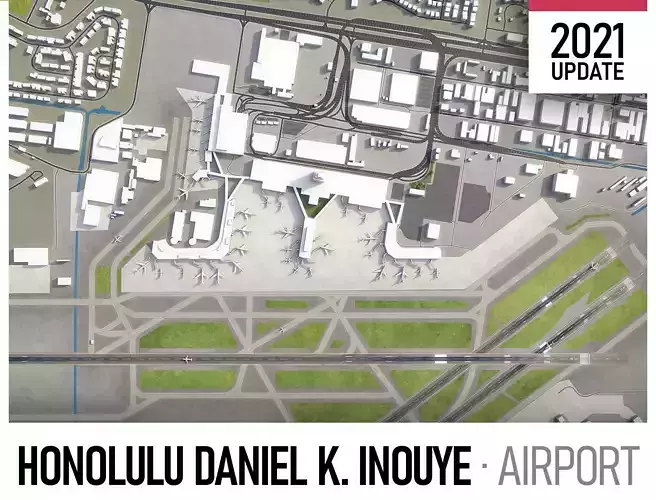
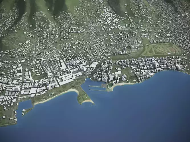
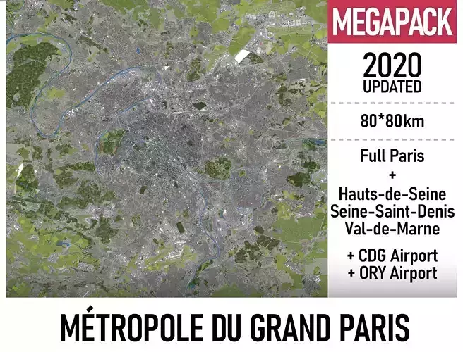
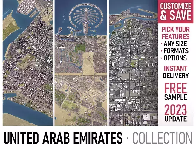
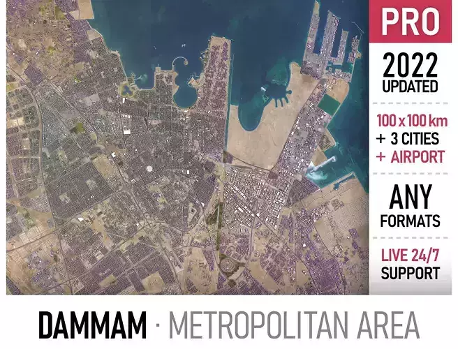
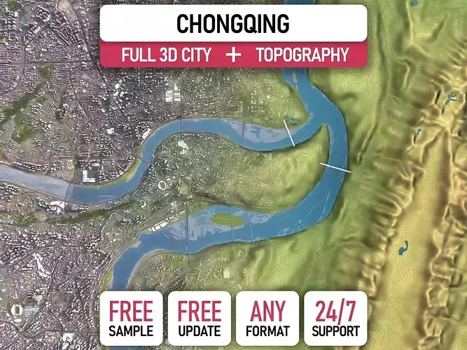
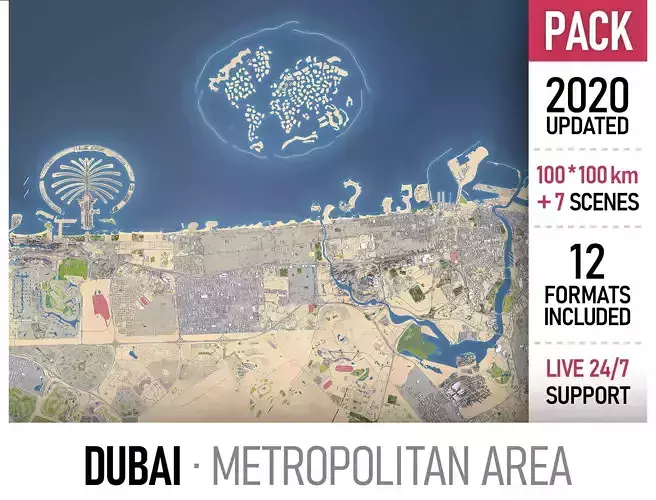
city map model area building center skyline landscape topography suburb neighborhood downtown skyscraper airport urban street park sketchup rhino
-
TRY BEFORE YOU BUY
- Send us a message to get a test scene of this product
- Download a generic sample - www.each.city/sample
-
WHAT IS INCLUDED
- DETAILS
- Coordinate reference system - NAD83 / UTM zone 4N (EPSG:26904)
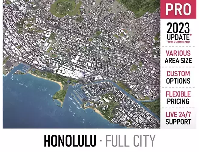
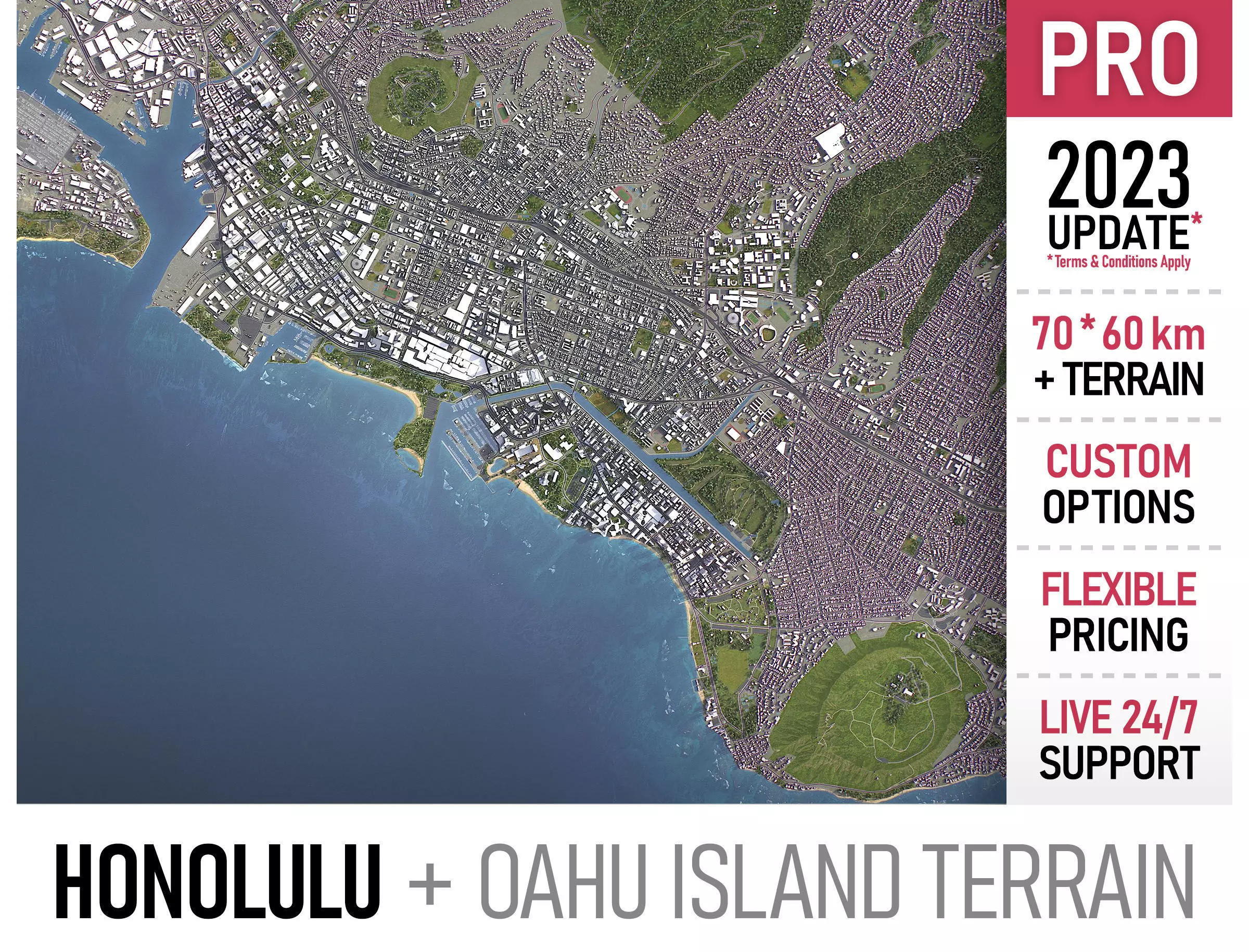
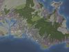
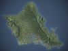
- Scene size - 70 x 60 km
- Units - Meters
- Scale - 1 : 1
- Updated - April 2023
- KEY BENEFITS
- 24/7 customer support
-
Extensive file format support (max, fbx, obj, dae, skp, 3dm, rvt, blend and more)
-
Any scene size or crop to area-of-interest — for best performance and format compatibility (request before paying)
- Buildings, landuse areas, roads and railways split by type (layers / named objects)
- Detailed landmarks with the regular updates and improvements
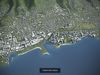
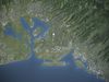
- High-resolution surface texture (1 meter resolution satellite image)
- The surface is flat, easy to add details and edit geometry
- Realistic low-poly trees and forests
- Product is ready to render out-of-the-box (3ds Max + Corona Render)
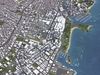
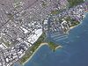
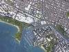
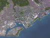
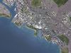
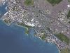
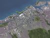
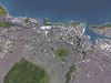
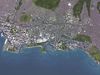
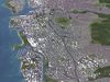
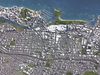
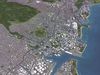
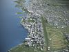
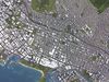
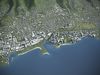
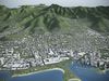
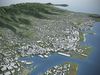
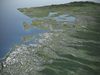
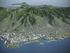
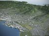
- PRESENTATION IMAGES
- 4K high-resolution renders (refer to images for level of detail and scene size)
- Produced in 3ds Max (other software requires its own rendering settings)
- MATERIALS
- Trees, vegetation, landuse and airport surface with the textures assigned
- Buildings are UV mapped, split by material IDs, no textures assigned
-
2023 UPDATE
- TERMS & CONDITIONS
- Only applies to new customers who placed an order through the HIRE ME option
- Fully customizable model based on the options listed below
- Fast turnaround, flexible pricing and discounts
- SCENE SIZE
-
Full city extents up to 100 x 100 km — or crop to the area of interest for better format compability and scene performance
-
Extended area up to 1000 x 1000 km — or any size options or slice to tiles
- MOST ACTUAL DATA
-
100% real buildings coverage — unlike other sellers we don’t use AI generated building footprints
-
Combining multiple sources — you may povide us with any dataset to include in the model
- GEOREFERENCING
-
Correct coordinate reference system — unlike other sellers we use only original reference system for each city
-
Geospatial anchors — allows you to place 3D content at any given latitude and longitude
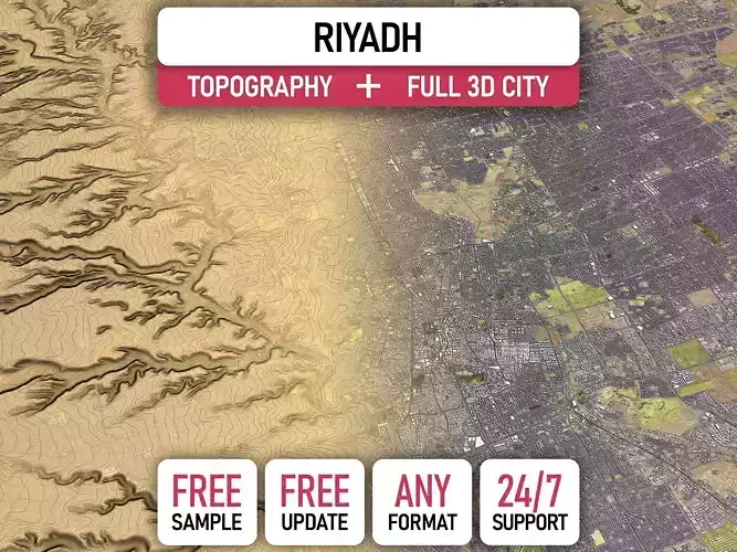
- TOPOGRAPHY TERRAIN
-
Up to 1 meter accuracy digital terrain model (DTM) — quad mesh
-
Multiple terrain LODs — triangle mesh optimized for the best polycount / details balance
- Buildings and roads placed on the optimized terrain
- Separate land surface and water bodies
-
High-resolution satellite or surface texture — up to 0.2 meter accuracy
-
Contour lines — 3D splines, up to 1 meter interval
- MANUAL MODELING
-
Buildings and structures — LOD2 and LOD3
-
Elevated highways — interchanges, bridges and flyovers
- TEXTURING
-
High-resolution surface texture — satellite image up to 0.5 meter accuracy
-
Streets and roads with markings texture — UV mapped along the center line
-
Procedural textures assigned to all buildings — LOD1 only
-
Realistic textures on individual buildings — LOD2 and LOD3
- TREES & FORESTS
-
Individual trees — real trees from OSM data
-
Procedural forests — based on distribution areas, convertible to individual trees
- OTHER EXTRAS
-
Individual buildings and streets — separate objects with address and/or name
-
Administrative boundaries of all levels — named polygons or outlines
-
Road and railway splines — for traffic animation, etc.
-
Public transport stops — individual named objects
- FILE FORMATS
-
max — Autodesk 3ds Max
-
fbx, obj, dae, 3ds — Exchange Formats
-
glb, gltf — Games, Web, AR/VR
-
unitypackage — Unity 3D
-
uproject — Unreal Engine
-
3dm — Rhino 3D
-
skp — SketchUp
-
rvt — Autodesk Revit
-
c4d — Cinema4D
-
blend — Blender
-
ma, mb — Autodesk Maya
-
dwg, dxf — Autodesk AutoCAD
-
IMPORTANT NOTE
- Any options under 2023 UPDATE section can only be ordered using the HIRE ME — flexible pricing applies