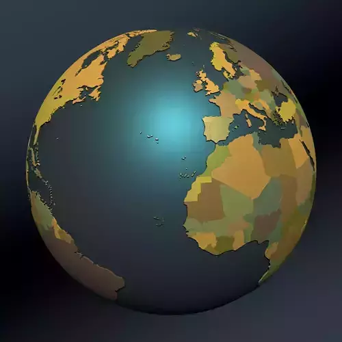
Political map earth globe with countries

Political map earth globe with countries 3D model

Description

A detailed geopolitical globe with seperate objects for every country on earth.

Every country is a single polygon object and contains of two parts. The extruded polygon object and a beveled cap as a seperate object.

The Globe is modeled in Cinema 4D. In the original C4D version you can change the thickness of the countries.

update 03.2021:

  • added Palestine as seperate country
  • correced the naming for Belgium, Luxembourg, Sudan, South sudan, Guyana and Suriname
  • changed some colors for better contrast
Item rating
5 0
K
karamanga 2022-02-07 15:21:28 UTC
Recommended
The model was alright and nearly did the job, thanks. Sadly, there are no country names (which is nowhere stated, so it was my fault). So..if you happen to have them somewhere, I'd be really grateful :)
S
solbaish 2021-04-30 14:01:20 UTC
Recommended
Sweet. OBJ didn't work, but the FBX looks good. Well labelled, so easy to isolate individual countries via locators - well worth the efforts. Excellent work.
Political map earth globe with countries
$79.00
 
Royalty Free License 
Political map earth globe with countries
$79.00
 
Royalty Free License 
Response 43% in 14.2h

3D Model formats

Format limitations
  • OBJ (.obj, .mtl)7.38 MB
  • Autodesk FBX (.fbx) (2 files)13.8 MBVersion: 7.3Version: 7.3
  • Cinema 4D (.c4d) (2 files)7.01 MBVersion: 21Renderer: Default Version: 2Renderer: Default

3D Model details

  • Publish date2018-02-16
  • Model ID#851928
  • Animated
  • Rigged
  • VR / AR / Low-poly
  • PBR
  • Geometry Polygon mesh
  • Polygons 179,245
  • Vertices 147,510
  • Textures
  • Materials
  • UV Mapping
  • Unwrapped UVs
  • Plugins used
  • Ready for 3D Printing
Help
Chat