-29.99%
$22.85
1/19
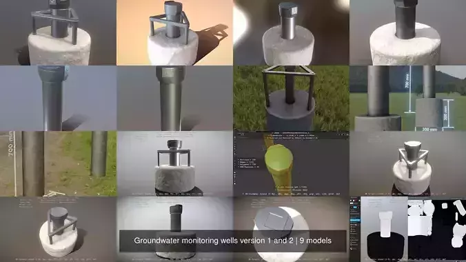
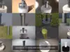


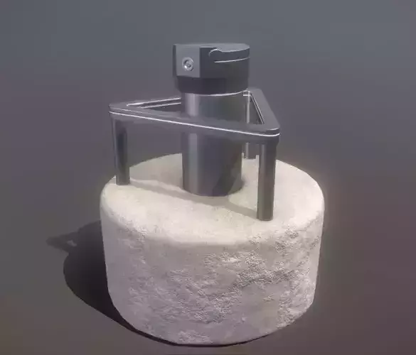
Groundwater monitoring wells version 1 and 2.
Parts:
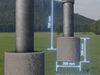
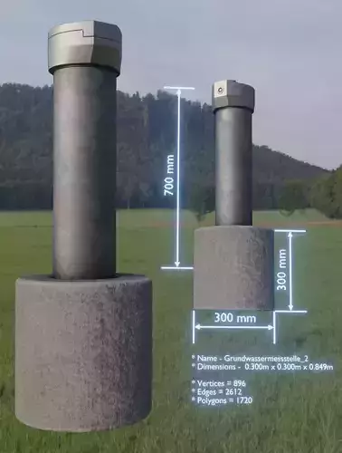
Dimensions - 0.300m x 0.300m x 0.849m
Vertices = 896
Edges = 2612
Polygons = 1720
Name - Grundwassermessstelle_1
Dimensions - 0.193m x 0.160m x 0.800m
Vertices = 398
Edges = 1153
Polygons = 758
Name - Grundwassermessstelle_3
Dimensions - 0.850m x 0.850m x 1.287m
Vertices = 1439
Edges = 4094
Polygons = 2668
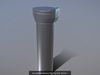
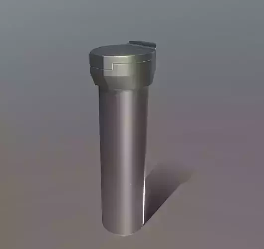
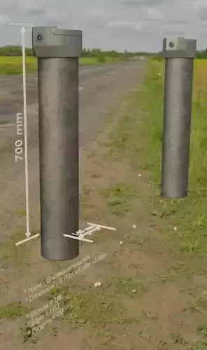
Groundwater measuring point 1 high-poly version.
Object Dimensions - 0.278m x 0.230m x 0.825m
Vertices = 438427
Edges = 1310223
Polygons = 871801
3D model formats:
Used software and 3d-model creator.
* A 3D model, which we use in our projects for our Software VIS-All-3D ( https://vis-all.de/ )
* This 3d model or those 3d models as well as the textures were created by 3DHaupt aka DennisH2010 ( https://www.cgtrader.com/3dhaupt ) for the software service John GmbH ( https://www.john-software.de ).
* Modeled and textured with Blender 2.9x ( https://www.blender.org/ )
Groundwater measuring point 1 high-poly version.
Verwendete Software und 3d-Modellersteller.
* Ein 3D-Modelle, das wir in unseren Projekten für VIS-All-3D verwenden (https://vis-all.de/).
* Das 3d-Modell oder die 3d-Modelle sowie die Texturen wurden von 3DHaupt ( https://www.cgtrader.com/3dhaupt ) für die Software-Service John GmbH ( https://www.john-software.de ) erstellt.
* Modelliert und texturiert mit Blender 2.9x ( https://www.blender.org/ )
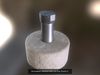
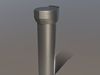
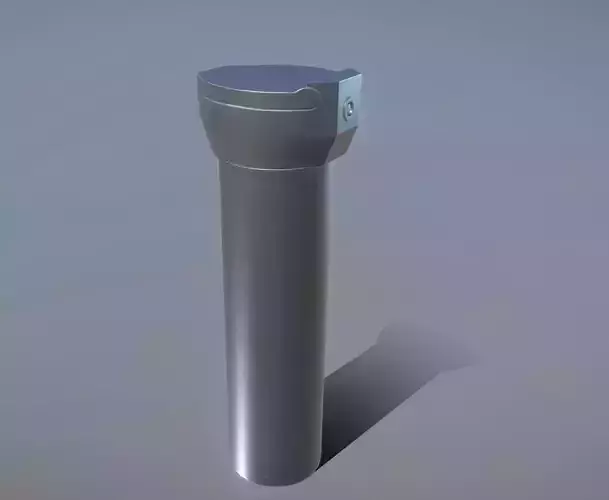
Groundwater measuring point 1 low-poly version .
Object Dimensions - 0.278m x 0.230m x 0.825m
Vertices = 398
Edges = 1153
Polygons = 758
3D model formats:
Used software and 3d-model creator.
* A 3D model, which we use in our projects for our Software VIS-All-3D ( https://vis-all.de/ )
* This 3d model or those 3d models as well as the textures were created by 3DHaupt aka DennisH2010 ( https://www.cgtrader.com/3dhaupt ) for the software service John GmbH ( https://www.john-software.de ).
* Modeled and textured with Blender 2.9x ( https://www.blender.org/ )
Verwendete Software und 3d-Modellersteller.
* Ein 3D-Modelle, das wir in unseren Projekten für VIS-All-3D verwenden (https://vis-all.de/).
* Das 3d-Modell oder die 3d-Modelle sowie die Texturen wurden von 3DHaupt ( https://www.cgtrader.com/3dhaupt ) für die Software-Service John GmbH ( https://www.john-software.de ) erstellt.
* Modelliert und texturiert mit Blender 2.9x ( https://www.blender.org/ )
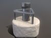
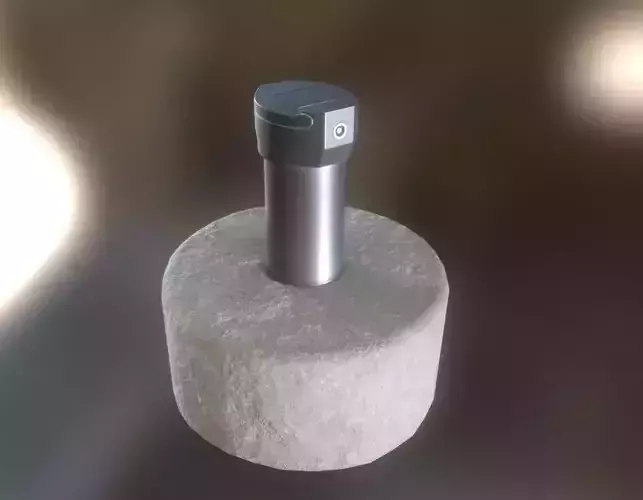
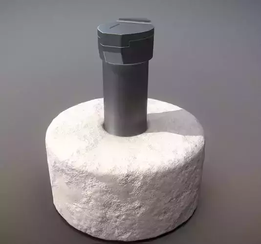
Groundwater measuring point 2 high-poly version with concrete foundation.
Object Dimensions - 0.763m x 0.764m x 0.852m
Vertices = 530668
Edges = 1586490
Polygons = 1055827
3D model formats:
Used software and 3d-model creator.
* A 3D model, which we use in our projects for our Software VIS-All-3D ( https://vis-all.de/ )
* This 3d model or those 3d models as well as the textures were created by 3DHaupt aka DennisH2010 ( https://www.cgtrader.com/3dhaupt ) for the software service John GmbH ( https://www.john-software.de ).
* Modeled and textured with Blender 2.9x ( https://www.blender.org/ )
Verwendete Software und 3d-Modellersteller.
* Ein 3D-Modelle, das wir in unseren Projekten für VIS-All-3D verwenden (https://vis-all.de/).
* Das 3d-Modell oder die 3d-Modelle sowie die Texturen wurden von 3DHaupt ( https://www.cgtrader.com/3dhaupt ) für die Software-Service John GmbH ( https://www.john-software.de ) erstellt.
* Modelliert und texturiert mit Blender 2.9x ( https://www.blender.org/ )
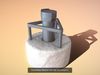
Groundwater measuring point 2 low-poly version with concrete foundation.
Object Dimensions - 0.760m x 0.764m x 0.855m
Vertices = 670
Edges = 1937
Polygons = 1270
3D model formats:
Used software and 3d-model creator.
* A 3D model, which we use in our projects for our Software VIS-All-3D ( https://vis-all.de/ )
* This 3d model or those 3d models as well as the textures were created by 3DHaupt aka DennisH2010 ( https://www.cgtrader.com/3dhaupt ) for the software service John GmbH ( https://www.john-software.de ).
* Modeled and textured with Blender 2.9x ( https://www.blender.org/ )
Verwendete Software und 3d-Modellersteller.
* Ein 3D-Modelle, das wir in unseren Projekten für VIS-All-3D verwenden (https://vis-all.de/).
* Das 3d-Modell oder die 3d-Modelle sowie die Texturen wurden von 3DHaupt ( https://www.cgtrader.com/3dhaupt ) für die Software-Service John GmbH ( https://www.john-software.de ) erstellt.
* Modelliert und texturiert mit Blender 2.9x ( https://www.blender.org/ )
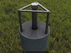
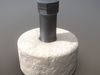
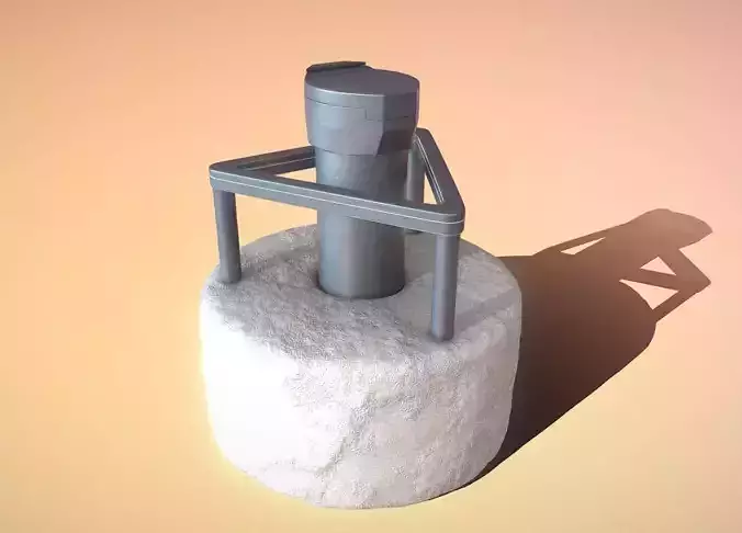
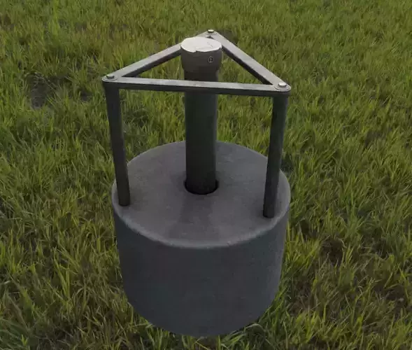
Groundwater measuring point 3 low-poly version with concrete foundation and triangular protection grid.
Object Dimensions - 0.760m x 0.764m x 0.855m
Vertices = 871
Edges = 2444
Polygons = 1576
3D model formats:
Used software and 3d-model creator.
* A 3D model, which we use in our projects for our Software VIS-All-3D ( https://vis-all.de/ )
* This 3d model or those 3d models as well as the textures were created by 3DHaupt aka DennisH2010 ( https://www.cgtrader.com/3dhaupt ) for the software service John GmbH ( https://www.john-software.de ).
* Modeled and textured with Blender 2.9x ( https://www.blender.org/ )
Verwendete Software und 3d-Modellersteller.
* Ein 3D-Modelle, das wir in unseren Projekten für VIS-All-3D verwenden (https://vis-all.de/).
* Das 3d-Modell oder die 3d-Modelle sowie die Texturen wurden von 3DHaupt ( https://www.cgtrader.com/3dhaupt ) für die Software-Service John GmbH ( https://www.john-software.de ) erstellt.
* Modelliert und texturiert mit Blender 2.9x ( https://www.blender.org/ )
Groundwater measuring point 3 high-poly version with concrete foundation and triangular protection grid.
Object Dimensions - 0.763m x 0.764m x 0.852m
Vertices = 618007
Edges = 1840515
Polygons = 1222513
3D model formats:
Used software and 3d-model creator.
* A 3D model, which we use in our projects for our Software VIS-All-3D ( https://vis-all.de/ )
* This 3d model or those 3d models as well as the textures were created by 3DHaupt aka DennisH2010 ( https://www.cgtrader.com/3dhaupt ) for the software service John GmbH ( https://www.john-software.de ).
* Modeled and textured with Blender 2.9x ( https://www.blender.org/ )
Verwendete Software und 3d-Modellersteller.
* Ein 3D-Modelle, das wir in unseren Projekten für VIS-All-3D verwenden (https://vis-all.de/).
* Das 3d-Modell oder die 3d-Modelle sowie die Texturen wurden von 3DHaupt ( https://www.cgtrader.com/3dhaupt ) für die Software-Service John GmbH ( https://www.john-software.de ) erstellt.
* Modelliert und texturiert mit Blender 2.9x ( https://www.blender.org/ )