1/28
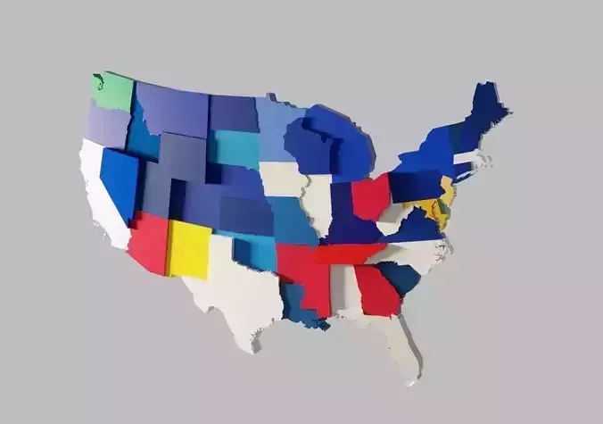
3D Map United States of America Continental US
Every state is slightly staggered (random) to get an interesting 3D effect.
You can move the single state (or change the height) if you want a perfectly flat map.
It includes all the states except Alaska and Hawaii.
Only in the blend file, every state has de dominant color of his flag.
I fixed some problems in the early version: now there's connecticut state (It was missing, I apologize for that) and the New york State is now correct.
Now the polygon count is lower for better performance.
Borders on the lakes (like Minnesota or Michigan) are not 100% accurate.
Bonus: US MAP Base Plate that can store all pieces except islands.
Bonus 2: USA MAP with Lakes (in this map there are lakes borders in the great lakes area).
You can use this model for 3d house decoration, weather forecast, geography lessons, powerpoint presentations, etc.
You can use every single state separately.
Features:
-100% Original and royalty free model. Modeled by me from scratch.
-The states are properly separated
-All parts are properly named in english (every state name)
-File formats: FBX, OBJ, DAE (Collada), X3D and Blend (2.79)
-I didn't use any texture
-No modifiers used
-Materials are included ONLY in Blend file (basic Cycles materials)
-Modeled in Blender
-Test Renderings: Cycles
I tested FBX and OBJ files with Blender 2.79 and 3ds Max 2013.
I tested DAE and X3D files with MeshLab
Polygon Count (Blend File)
Total Verts: 8934
Total Faces: 13065
Total Tris: 17532
I hope you like it!
REVIEWS & COMMENTS
accuracy, and usability.


