Atlanta

Atlanta 3D Model Collection

The collection consists of:4 models total
3D Model
Low-poly
PBR
.rfa
.3ds
.dwg
.fbx
.c4d
.dxf
.ma
.mb
.obj
.3dm
.skp
.max
.blend
.dae
.rvt
.stl
.mtl
.unitypackage
.uasset
.prefab
.pdf
.gltf
.glb
.ls10
.fbm


Description

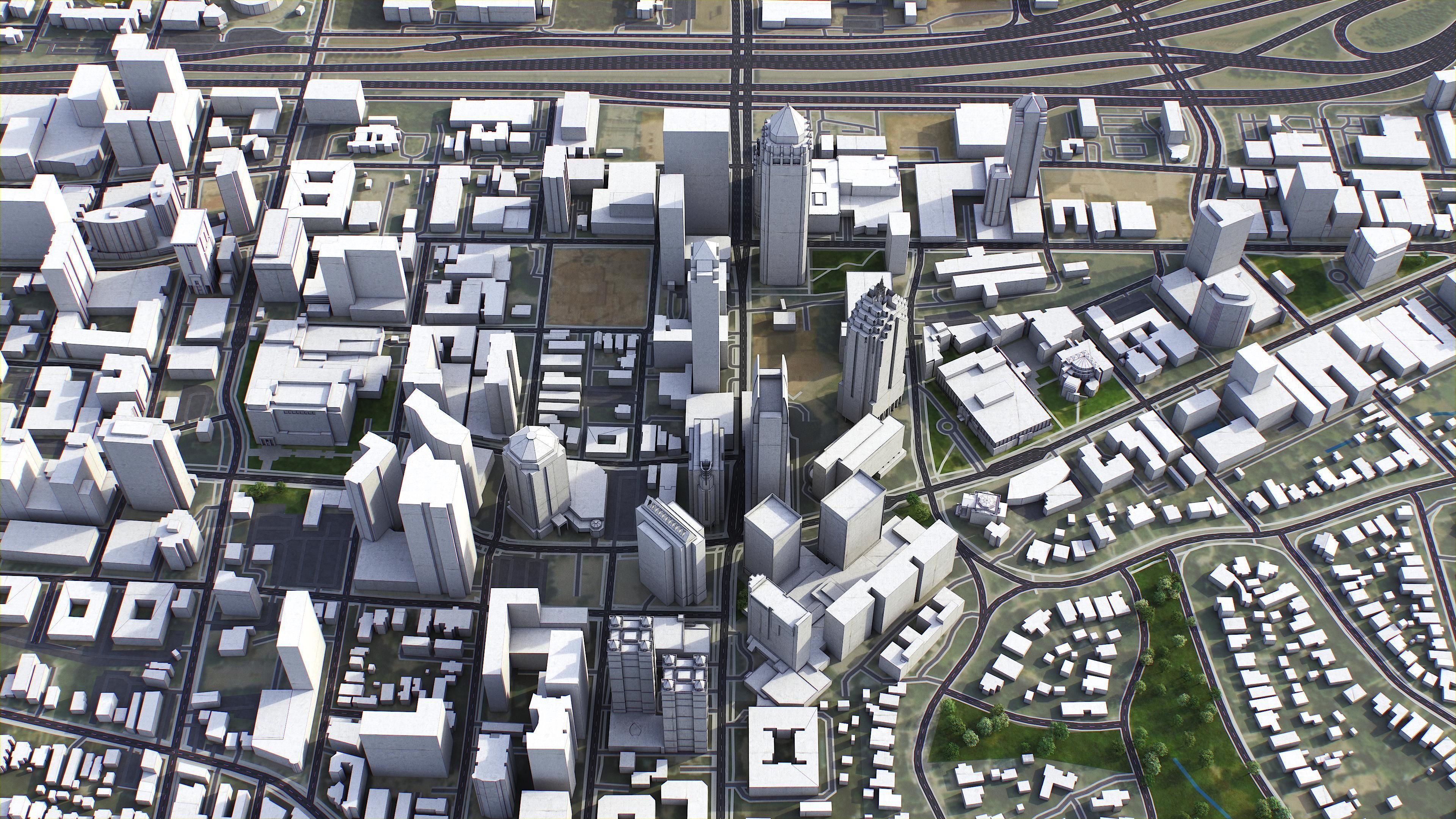
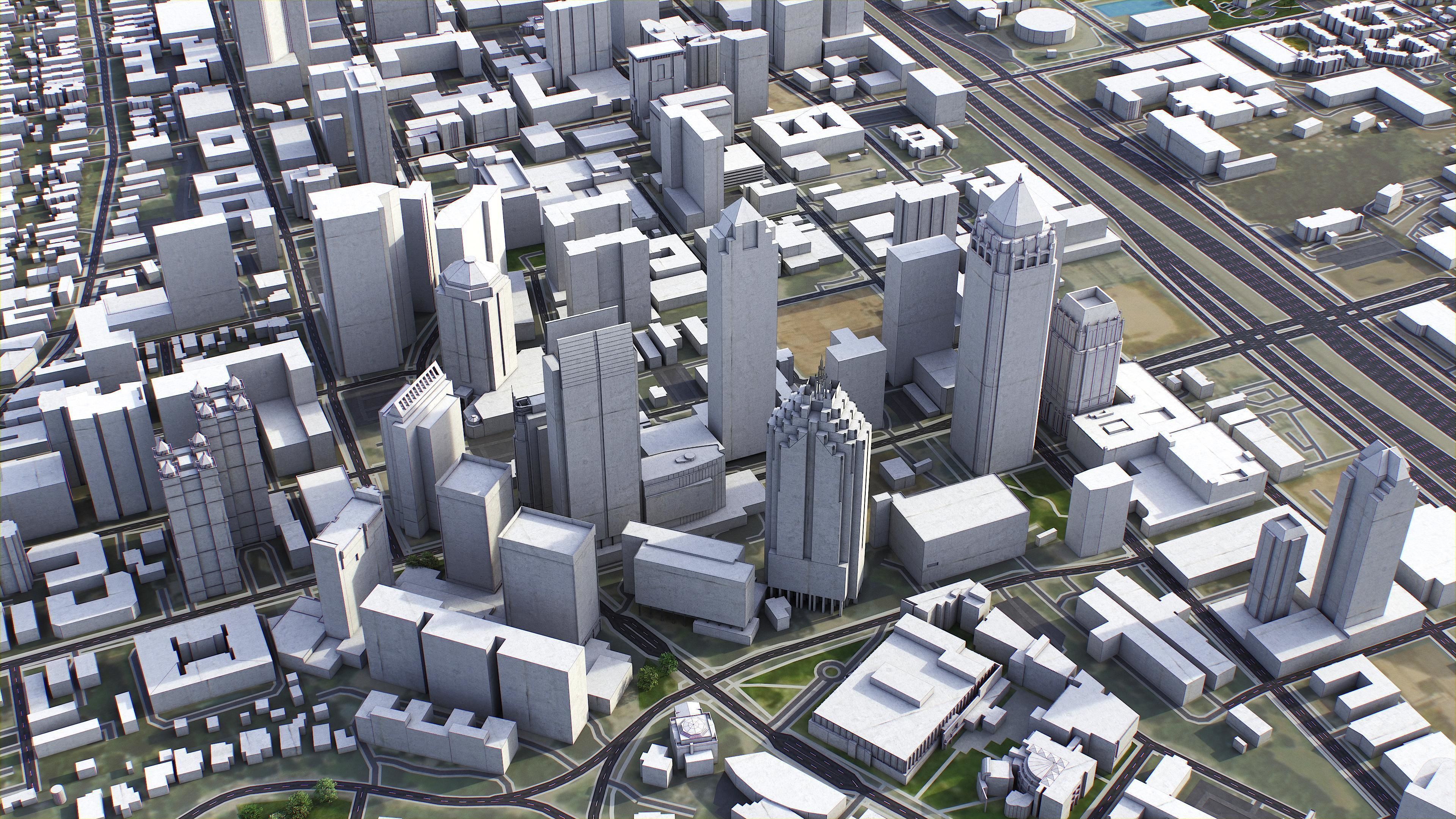
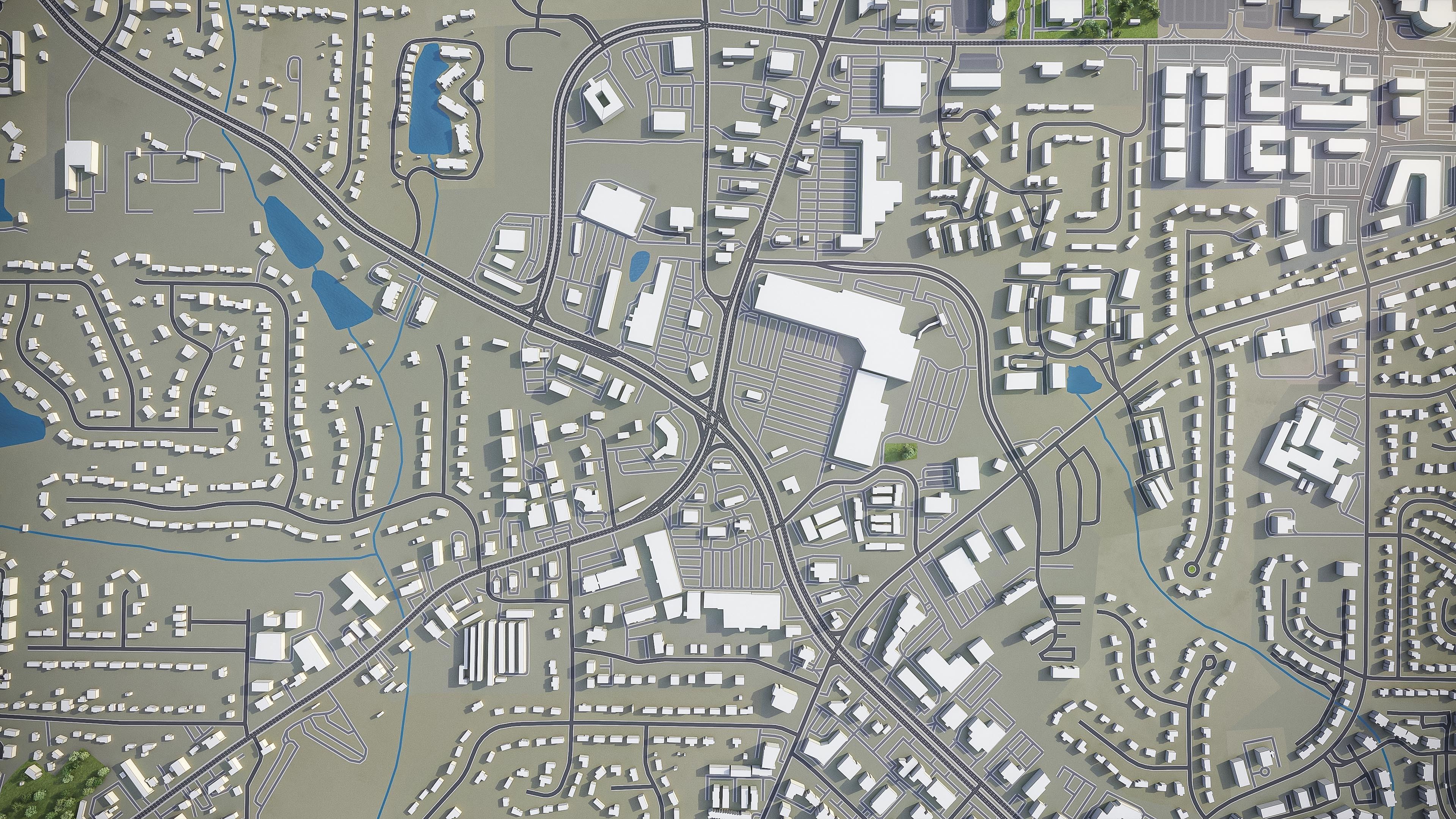
This is exact and accurate to scale 3D city model of Atlanta Metropolitan Area based on GIS data (January 2022)

PACKAGE CONTENTS

  • Fully customizable - you can select only the options you need!
  • This product includes scenes of various sizes and formats
    • 120 x 120 km - Complete scene (city and surrounding area)
    • Full city extents, downtown or airport
    • Any custom area size (please request before buying)
  • File formats (software supported)
    • MAX - Autodesk 3dsMax
    • FBX, OBJ, DAE - Exchange Formats
    • GLTF, GLB - Games, Web, AR/VR (request)
    • UNITYPACKAGE - Unity 3D
    • 3DM - Rhino 3D
    • SKP - SketchUp
    • RVT - Autodesk Revit (request)
    • STL - 3D Print (request)
    • C4D - Cinema4D
    • BLEND - Blender
    • MA, MB - Autodesk Maya
    • DWG, DXF - Autodesk AutoCAD

BASIC OPTIONS (included with the purchase)

  • KEY BENEFITS
    • 24/7 customer support
    • Regular updates and improvements
    • 100% buildings coverage from buildings footprint polygon geometries in all 50 U.S. States
    • Buildings, landuse areas, roads and railways split by type (layers / named objects)
    • The surface is flat, easy to add details and edit geometry (terrain on request)
    • Realistic low-poly trees and forests (max, fbx included, other formats on request)
    • Product is ready to render out-of-the-box (3dsmax + corona renderer)
  • PRESENTATION IMAGES
    • 4K high-resolution realistic renderings (refer to images for level of detail or request close-ups)
    • Rendered in 3dsMax (other software requires its own rendering settings)
  • MATERIALS
    • Trees, vegetation, landuse and airport surface with the textures assigned
    • Buildings are UVW mapped, split by material IDs, no textures assigned

CUSTOM OPTIONS (available at a special price - please request before buying)

  • TOPOGRAPHY TERRAIN
    • Up to 1 meter accuracy raw terrain object (USGS 3D Elevation Program)
    • Multiple LODs optimized for the best polycount/details balance
    • Contour lines (up to 1 meter interval)
    • High-resolution (up to 20cm accuracy) satellite or surface texture
    • Buildings and roads placed on the optimized terrain
  • OTHER EXTRAS
    • On-demand custom update
    • Crop to custom area size or slice to tiles
    • Procedural textures assigned to all buildings
    • Individual buildings and streets (with address and/or name)
    • Administrative boundaries of all levels (named polygons or outlines)
    • Road and railway splines for traffic animation
    • Public transport stops with names

CONTACT US

  • Discounts
  • 24/7 customer support
  • Custom and on-demand options
  • Adjustments and improvements
Item rating
0 0
Atlanta
$599.00
 
Royalty Free License 
Atlanta
$599.00
 
Royalty Free License 
Response 99% in 0.1h
3D Modeling
Low-poly Modeling
UV mapping
Hire me

3D Collection formats

Format limitations
  • Autodesk FBX(.fbx) 4/4
  • Collada(.dae) 4/4
  • Autodesk 3ds Max(.max) 4/4
  • AutoCAD(.dwg) 4/4
  • DXF(.dxf) 4/4
  • Autodesk Maya(.ma) 3/4
  • Autodesk Maya(.mb) 3/4
  • Cinema 4D(.c4d) 3/4
  • Blender(.blend) 3/4
  • Rhinoceros 3D(.3dm) 4/4
  • Unity 3D(.unitypackage) 3/4
  • Unity 3D(.prefab) 3/4
  • OBJ(.obj) 4/4
  • OBJ(.mtl) 4/4
  • Sketchup(.skp) 4/4
  • PDF(.pdf) 3/4
  • 3D Studio(.3ds) 3/4
  • glTF(.gltf) 3/4
  • glTF(.glb) 3/4
  • Lumion(.ls10) 3/4
  • Autodesk Revit(.rfa) 3/4
  • Autodesk Revit(.rvt) 3/4
  • Stereolithography(.stl) 3/4
  • UnrealEngine(.uasset) 3/4
  • fbm(.fbm) 1/4

3D Collection details

  • Publish date2020-05-31
  • Collection ID#2448090
  • Animated 0/4
  • Rigged 0/4
  • VR / AR / Low-poly 4/4
  • PBR 3/4
  • Ready for 3D Printing
Help
Chat